9 Sept 2026
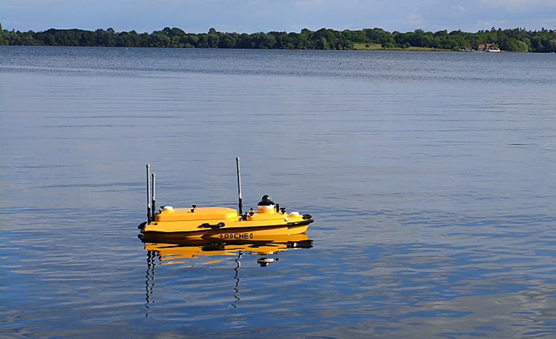
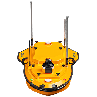
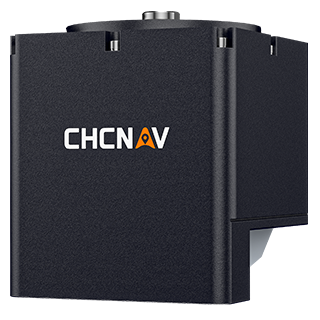
Before a pipeline is laid across the bed of a reservoir, someone has to know what the bed looks like. The route has to follow the terrain, avoid the awkward sections, and be recorded well enough that the finished work can be checked against it afterwards. At a reservoir in Europe, that job was done with a CHCNAV Apache 4 unmanned surface vessel carrying an HQ-400 compact multibeam echosounder. The survey covered 3.27 square kilometres in three days, in water averaging 15 metres deep, and produced the bathymetry the pipeline team needed for both route planning and acceptance.
The quality of a pipeline laid in a reservoir affects the reservoir's operation and the security of the water supply it serves, so the work is checked at both ends. Before installation, the team needs the underwater terrain in enough detail to set the route and the layout, which is what makes the pipeline safe to build and economical to run. After installation, the same area is surveyed again to confirm the work was completed as planned.
Both surveys have to happen without disturbing the reservoir. This is a managed water body in an agricultural landscape rather than a working waterway, and the usual approach of bringing in a crewed vessel carries problems here: a large boat is difficult to transport to the site, charter costs are high, and the environmental conditions attached to a reservoir are strict. Those constraints are what pointed the team towards a small unmanned platform.
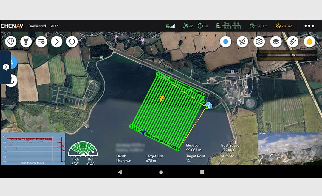
Setup was short. The crew installed and calibrated the HQ-400, ran the vessel's power checks, divided the reservoir into survey blocks, and let the software generate the survey lines for each block. From that point the Apache 4 followed the planned lines under its own control.
What the crew noticed was how little was left to do during acquisition. There was no laptop to carry and no remote desktop session to manage. The handheld controller showed the vessel's position on the planned track, its heading and speed, and the progress through each block, which was enough to supervise the whole survey from the bank.
In water averaging 15 metres deep, the Apache 4 and HQ-400 completed 3.27 square kilometres of the reservoir in three days. Because the vessel holds the planned line rather than approximating it, the coverage is even: swaths overlap as designed and the spacing between soundings stays consistent across the survey area. On a crewed survey the same lines are steered by hand, and the point density tends to vary with how closely the helm follows the plan.
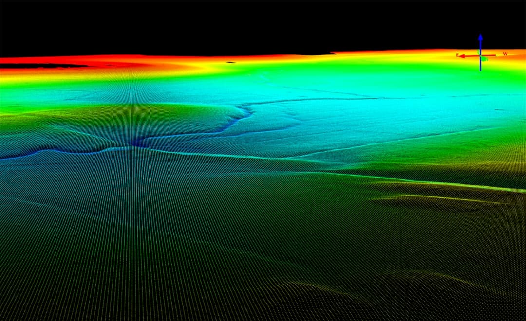
The raw data was processed in CHC Navigation's CMS software, which produced a high-precision point cloud of the reservoir bed and exported it in LAS format. That is the deliverable the pipeline construction team works from: with the bed modelled, the planned position of the pipeline can be checked against the actual terrain before anything is installed.
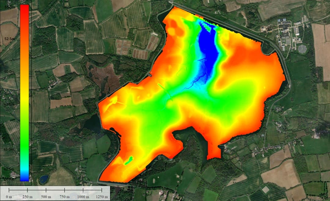
The results were then brought into Global Mapper® software and displayed over satellite imagery of the site. Exported as a TIF, that view shows how the bed changes across the reservoir in a form the wider project team can read without survey software. It is the same processing route used on the German lake survey reported earlier this year, applied here to an area roughly ten times the size.
Two things stood out on this project. The first is line-following accuracy. The Apache 4 navigates the planned route precisely, which addresses the uneven point density and irregular line spacing that come with steering by hand, and makes the coverage easier to defend when the survey is used for acceptance.
The second is what that accuracy is worth at this scale. Holding the line matters more over 3.27 square kilometres than over a small basin, because an inconsistency early in the survey is repeated across every subsequent block. Add the straightforward installation, the absence of a crewed vessel on a managed reservoir, and the lower charter and mobilisation costs across a programme of repeat surveys, and the case is as much economic as technical.
| Survey need | Crewed vessel with traditional multibeam | Apache 4 USV with HQ-400 |
|---|---|---|
| Getting to site | A large boat is difficult to transport to an inland reservoir | Light enough to carry in and launch from the bank |
| Cost | Charter costs are high, and repeat surveys multiply them | Simple to install and operate, lower cost across a survey programme |
| Line following | Lines are steered by hand, so point density and spacing vary | Follows the planned line, giving even coverage and consistent spacing |
| Environmental conditions | A fuel-powered vessel on a managed reservoir | No fuel-powered boat on the water |
| Field workflow | Crew on board for the duration of acquisition | Supervised from the bank on a handheld controller |
The pairing of a compact USV and an integrated multibeam suits any water body where the survey matters but the access is awkward: reservoirs and lakes, harbour basins, inland channels and coastal shallows. CHC Navigation's unmanned surface vessels with multibeam have been used for underwater terrain surveys in South Korea, Japan, Indonesia, the Maldives and the Philippines, alongside this project in Europe.
For the full range of unmanned surface vessels and hydrographic sensors, see our marine surveying solutions.
CHC Navigation (CHCNAV) develops advanced mapping, navigation, and positioning solutions designed to increase productivity and efficiency. Serving industries such as geospatial, agriculture, machine control and autonomy, CHCNAV delivers innovative technologies that empower professionals and drive industry advancement. With a global presence spanning over 140 countries and a team of more than 2,200 professionals, CHC Navigation is recognized as a leader in the geospatial industry and beyond. For more information about CHC Navigation [300627.SZ], please visit: https://geospatial.chcnav.com/about/overview
CHCNAV APACHE 4
Hydrographic and Bathymetric Surveys USV
CHCNAV HQ-400
Lightweight Integrated Multibeam Echo Sounder







































.png)