30 Jul 2026
In the forest around Bartenstein in Germany, a survey team needed an underwater topographic map of a small freshwater lake, without moving a large crewed boat into a protected natural site. Working from the shore, they mapped the lakebed with the CHC Navigation Apache 4 Pro unmanned surface vessel carrying an HQ-400 multibeam echosounder, and produced the finished map the same day. This is how the survey came together.
The survey site is a freshwater lake set in the woodland around Bartenstein. The water body is about 180 metres long and 90 metres wide, with a maximum depth of roughly 6 metres. The work was part of a water resource investigation, so the team needed an accurate record of the lakebed shape across the whole basin.
The goal was a clear deliverable, an underwater topographic map of the lake, but the setting made a traditional survey difficult:
What the team wanted was a compact, lightweight platform that two or three people could carry and operate, paired with a data workflow fast enough to turn the field survey into a finished map quickly.
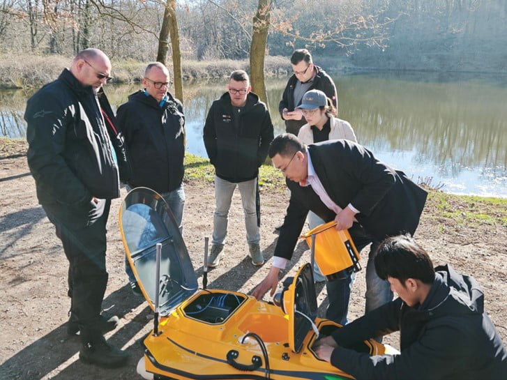
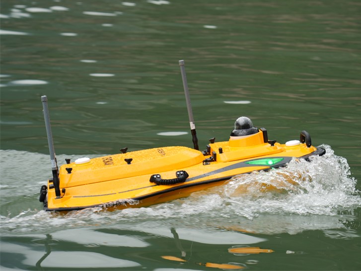
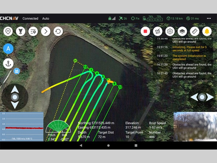
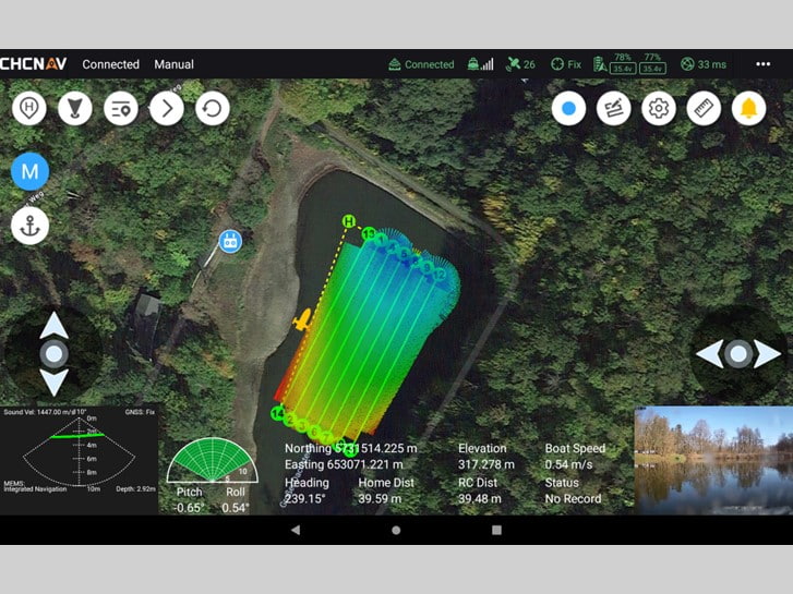
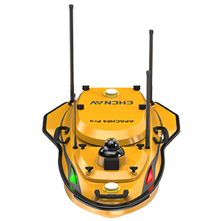
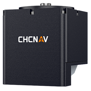
The team paired the Apache 4 Pro, a compact unmanned surface vessel, with the HQ-400, a compact multibeam echosounder built for shallow-water bathymetry. The USV is small enough to carry to the water and launch by hand, so no trailer, ramp or crewed boat is needed, and its low-impact operation suits a protected site. Field acquisition ran in the on-board survey software, which drives the vessel and logs the multibeam soundings live as it covers the lake.
On site, the team assembled and checked the equipment on the shore in about 8 minutes, completing the pre-launch installation and setup before the vessel entered the water. From there the Apache 4 Pro ran its survey lines across the lake while the HQ-400 recorded a dense swath of depth soundings, building full coverage of the lakebed rather than a set of single-point measurements.
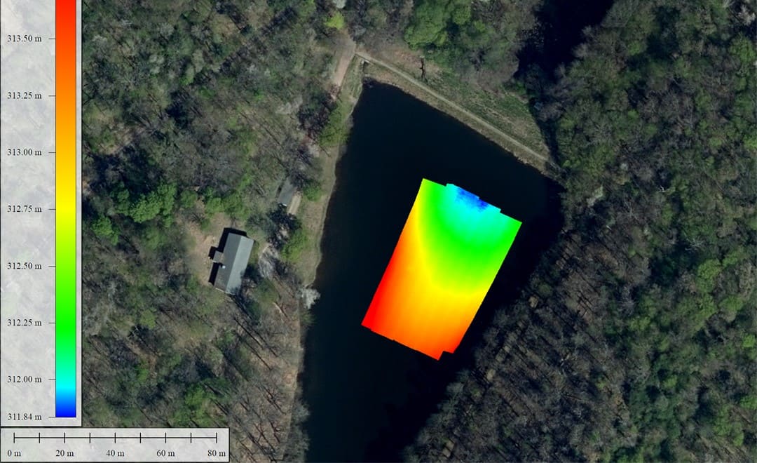
The field data was processed in the CMS software, with post-processing completed in about 20 minutes. The team exported the result as a LAS point cloud, then brought it into Global Mapper and overlaid it on a satellite base map to produce the finished underwater topographic map of the lake. The result gave the water resource investigation an accurate, full-coverage picture of the basin.
Running the survey from a compact unmanned platform removed the cost of chartering and crewing a boat, kept the footprint on a protected site to a minimum, and still delivered the full-coverage underwater topographic map the project needed. For repeat work on lakes, reservoirs and other inland water bodies, that mix of easy transport, fast setup and quick processing is the core benefit of a USV based bathymetric workflow.
| Consideration | Large crewed boat | Apache 4 Pro USV with HQ-400 |
|---|---|---|
| Transport and launch | Trailer and ramp, hard to reach a forest lake | Carried in by hand, launched from the shore |
| Cost | Boat charter plus crew | No boat charter |
| Team and handling | Larger crew | Two to three people |
| Site impact | Higher footprint on a protected area | Compact, low-impact operation |
| Setup time | Longer mobilisation | About 8 minutes on the shore |
| Processing | Longer office turnaround | About 20 minutes to a finished map |
For teams planning inland bathymetric surveys, the wider range of CHC Navigation marine surveying solutions covers USV platforms and multibeam payloads for hydrographic and bathymetric work.
CHC Navigation (CHCNAV) develops advanced mapping, navigation, and positioning solutions designed to increase productivity and efficiency. Serving industries such as geospatial, agriculture, machine control and autonomy, CHCNAV delivers innovative technologies that empower professionals and drive industry advancement. With a global presence spanning over 140 countries and a team of more than 2,200 professionals, CHC Navigation is recognized as a leader in the geospatial industry and beyond. For more information about CHC Navigation [Huace:300627.SZ], please visit: https://geospatial.chcnav.com/about/overview
CHCNAV APACHE 4 PRO
Hydrographic and Bathymetric Surveys USV
CHCNAV HQ-400
Lightweight Integrated Multibeam Echo Sounder







































.png)