10 Aug 2026
Surveying inside a working railway station leaves little room for tripods, ground control points, or long occupation times. For a new escalator project at a metro station in South Korea, the DAEGYEONG Survey System needed to reconstruct a busy, confined space accurately and to do it without disrupting daily operations. The team captured the full site in 30 minutes with the CHCNAV RS10 handheld SLAM scanner, processed the point cloud in CHCNAV CoPre, and built the BIM model in Autodesk® Revit® software to simulate the escalator installation before any construction began.
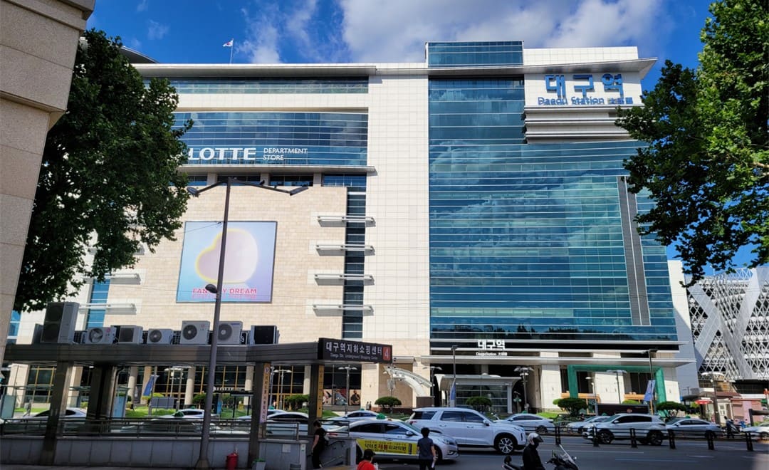
DAEGYEONG Survey System carried out this project at the station on a busy urban rail line in South Korea. The objective was to build a BIM model that could simulate the construction of new escalators at the station. The work called for an accurate digital reconstruction of the station environment, so the team could assess how the escalator trusses would be transported and installed within a confined and operational railway space.
The brief combined tight access, high accuracy and minimal disruption:
DAEGYEONG Survey System built the project around a single connected workflow. The RS10 handled data capture, CHCNAV CoPre processed the point cloud and exported it directly in RCP format, and Revit software turned that point cloud into the BIM model. Because CoPre exports RCP directly, the point cloud imported into Revit software without an extra conversion through ReCap and without the need for CAD drawings, which helped reduce software cost and simplify the BIM workflow.
| Item | Product and role |
|---|---|
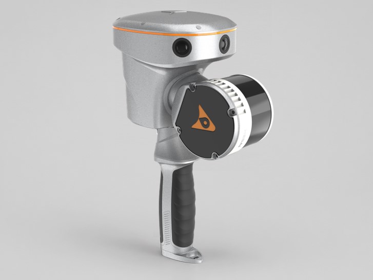
| Handheld scanner | CHCNAV RS10, integrating GNSS RTK, laser scanning and visual SLAM for field capture without ground control points |
| Panoramic imaging | Insta360 for panoramic photos alongside the point cloud |
| Processing software | CHCNAV CoPre for SLAM data processing and direct export in RCP format |
| BIM software | Revit software for slicing, measurement, BIM modelling and construction simulation |
In a crowded, operational station, the method of capture shapes the whole project. The comparison below shows why the team chose the RS10 over terrestrial laser scanning (TLS) or a total station.
| Aspect | CHCNAV RS10 (handheld SLAM) | Terrestrial laser scanner (TLS) | Total station |
|---|---|---|---|
| Data acquisition | Data collected while walking, full site captured in about 30 minutes; no tripod, no ground control points, and limited surveying experience required | Complex structures need multiple scan positions and targets for registration; field acquisition can take 5 to 10 hours | Captures discrete points only; surveyor point selection directly affects modelling quality; acquisition of complex areas is slow |
| Data processing | Direct RCP point cloud output plus panoramic photos, processed in about one hour; real‑time feedback confirms data completeness on site | Multiple scans must be registered; large datasets need high computer specifications and long processing times, often more than one day | No surface information, so manual interpretation is required, and curved or complex surfaces cannot be fully represented |
| Fit for BIM | Simple workflow, high efficiency and strong visualisation for BIM and construction simulation | Accurate but less efficient, more complex, and higher in cost and operational requirements | High accuracy on single points, but low efficiency and no visual context, better suited to simple measurement |
The team confirmed the scanning area and walking route to cover the escalators, the station structures, the construction equipment access paths and the surrounding elements in a single pass.
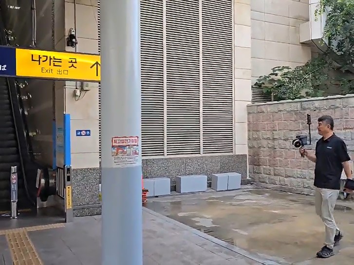
The surveyor walked the route and collected the point cloud in the field with the RS10. The deep fusion of RTK and SLAM supported high-precision capture even without ground control points, and one operator completed the full-site acquisition in about 30 minutes.
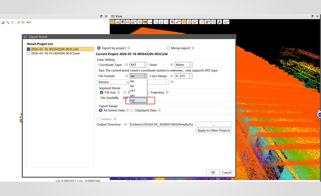
The raw data was processed in CHCNAV CoPre, which exported the point cloud directly in RCP format. That direct output removed the extra conversion step and prepared the data for import into Revit software.
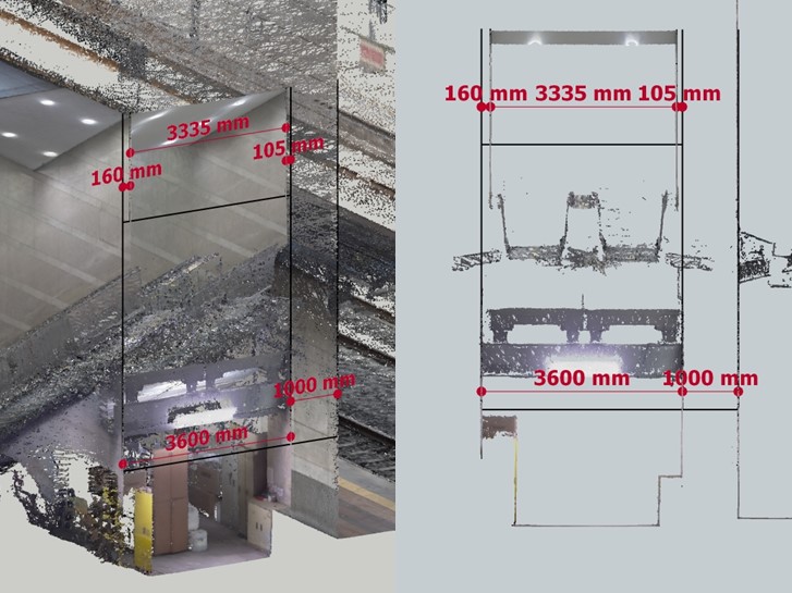
The point cloud imported directly into Revit software for slicing and measurement. Working from the point cloud, the team obtained accurate elevations and section dimensions across the escalator area.
| Measurement from the point cloud | Value |
|---|---|
| Escalator width | 3335 mm |
| Channel width | 3600 mm |
| Structural column width | 1000 mm |
| Left side panel spacing | 160 mm |
| Right side panel spacing | 105 mm |
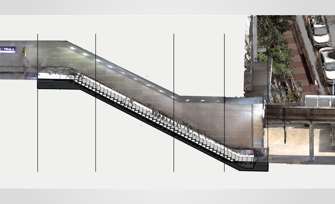
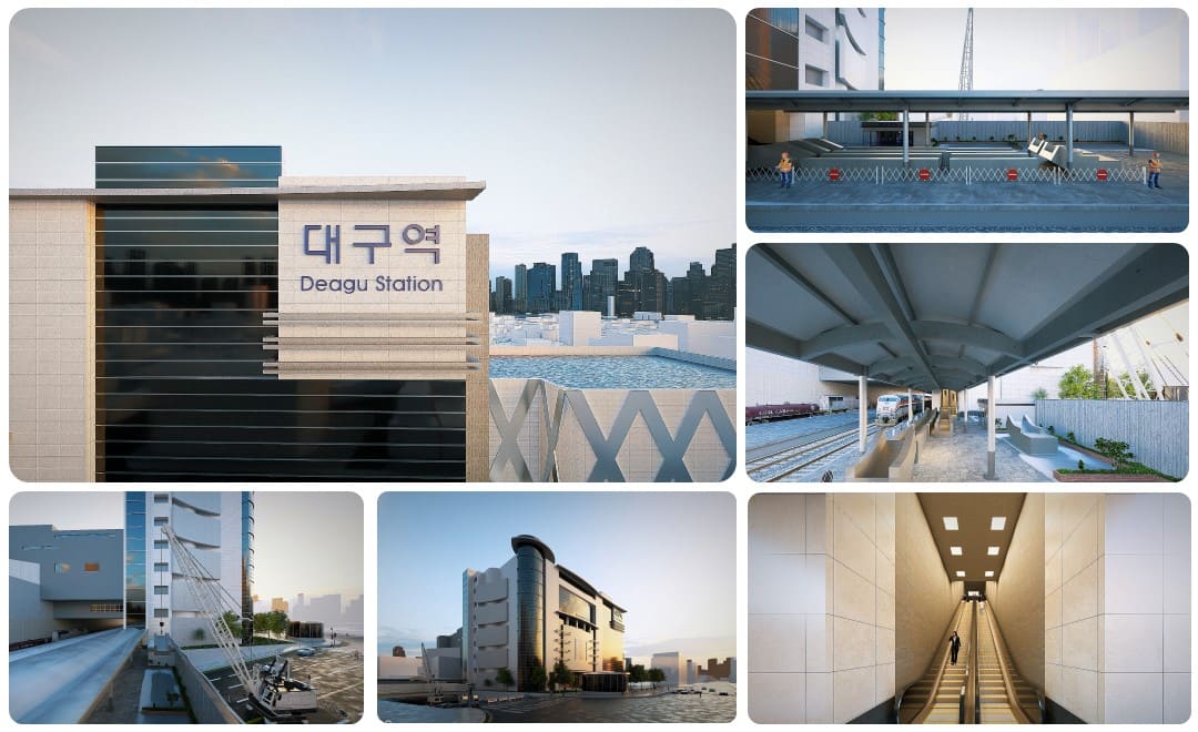
The team generated the BIM model in Revit software from the point cloud, following a scan to BIM workflow. The model reconstructed the escalators, the station structure and the surrounding environment in a form ready for analysis.
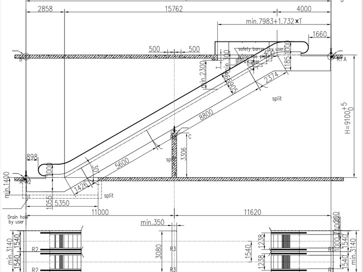
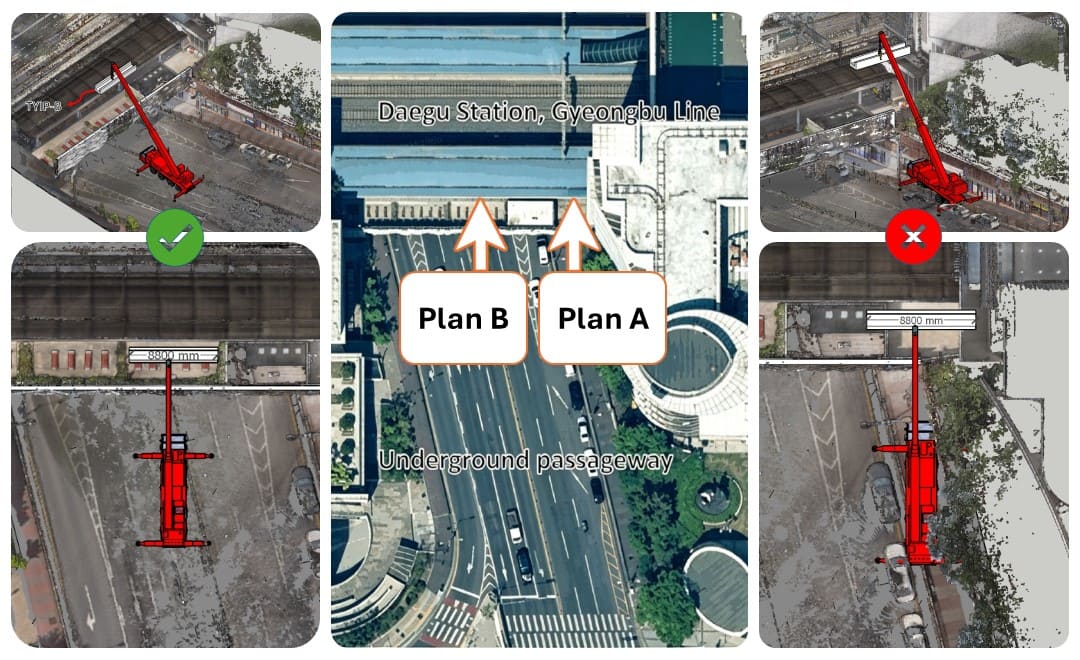
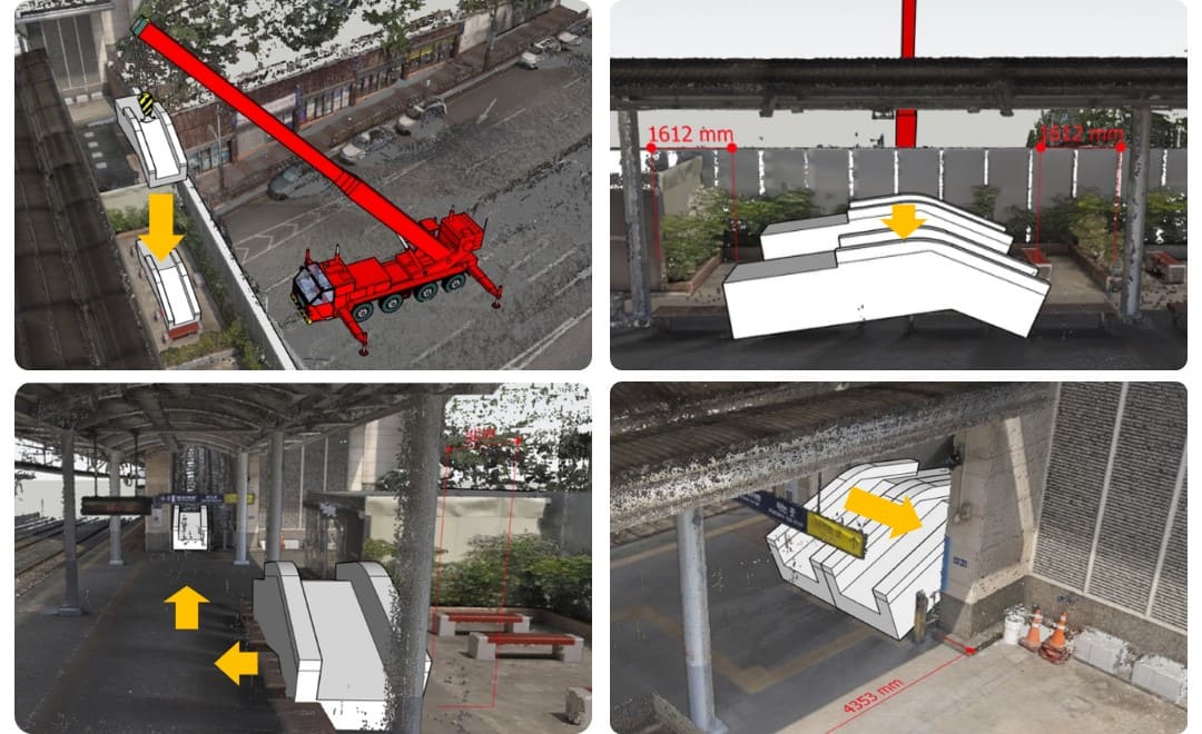
With the point cloud and BIM model in place, the team ran the analysis and construction simulation, then submitted the final deliverables. The team modelled the escalators, the station structure, the construction equipment and the surrounding environment, then simulated the full disassembly, relocation, lifting and installation sequence before construction. That let them identify potential collisions, congestion, clearance issues and schedule conflicts in advance. The deliverables included a truss partitioning plan, a truss structure diagram, an alignment comparison between the model and the point cloud, and a crane site selection simulation.
The scan to BIM workflow reconstructed a busy station accurately while keeping field time short. One operator captured the full site in about 30 minutes, which reduced field labour and limited disruption to station operations. The high-precision point cloud supported reliable construction accuracy, and the direct RCP output kept the path from field data to BIM model short.
| Outcome | Detail |
|---|---|
| Field acquisition | Full site captured by one operator in about 30 minutes |
| Ground control | No ground control points required, using RTK and SLAM fusion |
| Processing | Point cloud processed in CoPre and exported directly in RCP in about one hour |
| Modelling | Point cloud imported straight into Revit software for slicing, measurement and BIM modelling |
| Deliverables | BIM model, truss partitioning plan, model to point cloud comparison, and crane site selection simulation |
The project team pointed to four benefits from the approach:
By simulating the full disassembly, relocation, lifting and installation process before construction, the team could resolve problems on screen rather than on site. Testing the sequence against an accurate digital twin of the station reduced the risk of collisions, congestion and clearance issues once the escalator trusses arrived, and gave every stakeholder a shared, visual reference for the plan.
| RS10 at a glance | Specification |
|---|---|
| Core technology | RTK, LiDAR and SLAM deep fusion |
| Scan range | 120 m (16 lines); 300 m (32 lines) |
| Absolute accuracy | Horizontal under 3 cm, vertical under 3 cm |
| Relative accuracy | Under 1 cm |
| GNSS antenna | Fourth‑generation air dielectric antenna for reliable RTK positioning |
| Raw point cloud formats | RCP, E57, LAS, LAZ, PTS |
📄 Download the full case study (PDF)
For teams documenting complex, operational spaces where tripods and ground control are impractical, the metro station project is a clear data point: a handheld SLAM scanner with a direct scan to BIM path can reconstruct a site in minutes and support construction simulation before work begins. The RS10 sits within the CHC Navigation 3D mobile mapping and surveying and engineering solutions, alongside the RS7 handheld LiDAR scanner for indoor and building work.
CHC Navigation (CHCNAV) develops advanced mapping, navigation, and positioning solutions designed to increase productivity and efficiency. Serving industries such as geospatial, agriculture, machine control and autonomy, CHCNAV delivers innovative technologies that empower professionals and drive industry advancement. With a global presence spanning over 140 countries and a team of more than 2,200 professionals, CHC Navigation is recognized as a leader in the geospatial industry and beyond. For more information about CHC Navigation [300627.SZ], please visit: https://geospatial.chcnav.com/about/overview
Have a question about our handheld SLAM scanning solutions?







































.png)