10 Jul 2026
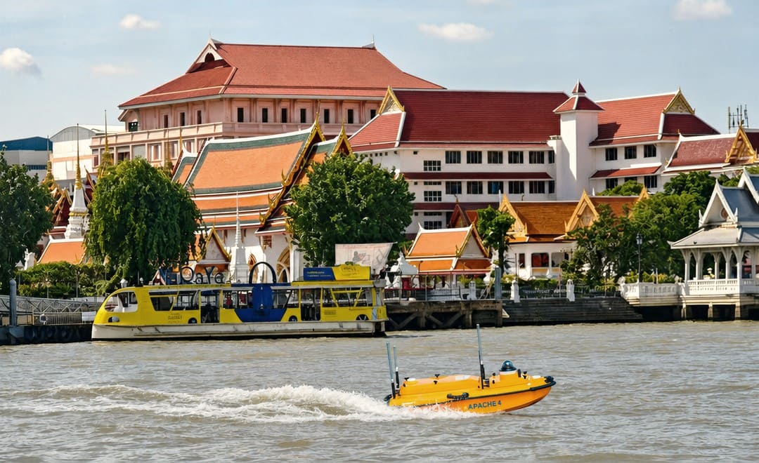
On a busy stretch of the Chao Phraya River in central Bangkok, a survey team needed to measure river flow and discharge without putting a crewed boat in the water. Working from the bank, they completed a full flow measurement in 10 to 15 minutes using the CHC Navigation Apache 4 unmanned surface vessel carrying a RiverStar RS-600 ADCP. This is how the survey came together.
The measurement cross section sits on the Chao Phraya as it runs through Bangkok. The river is around 250 metres wide here, with a maximum depth of about 18 metres. It lies roughly 20 kilometres upstream from the estuary at the Gulf of Thailand, so the tidal range is significant and the flow shifts through the day.
It is also a working waterway. Tourist boats, ferries and cargo vessels pass through the channel constantly, which shapes both how the survey can be run and how safe it is to be on the water.
The goal was a hydrologic survey, specifically a record of flow rate and water volume across the channel. In this setting, the traditional approach of running an acoustic Doppler current profiler from a crewed boat carries real friction:
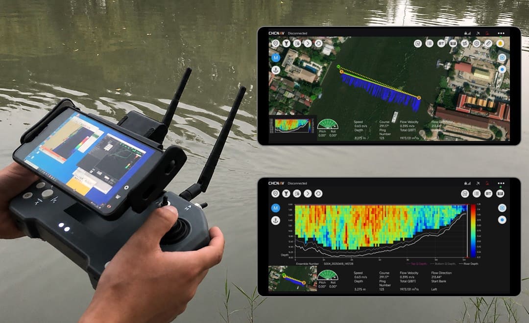
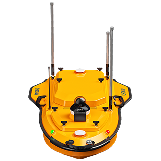
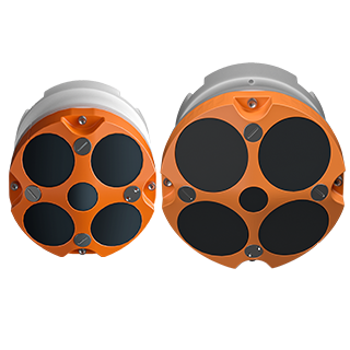
The team paired the Apache 4, a compact unmanned surface vessel, with the RiverStar RS-600, a 600 kHz acoustic Doppler current profiler built for river discharge and flow measurement. The USV is small enough to launch by hand from the riverbank, so no crewed boat and no launch ramp are needed. Field acquisition ran in EasySail software, which drives the vessel and logs the ADCP data live as it crosses the section.
On site, hardware setup and checks took about 5 minutes. A single crossing to collect one valid dataset took another 5 minutes, so the complete cycle ran to roughly 10 to 15 minutes. One person handled the acquisition from the bank.
The channel traffic was managed as part of the run. When larger vessels approached, the operator adjusted the Apache 4's speed and switched it to hover mode, which kept the vessel safe in the shipping lane and kept the ADCP data continuous through the crossing.
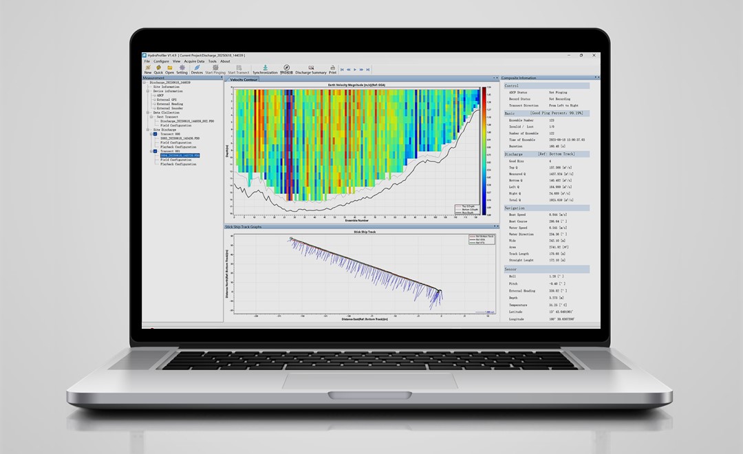
Field data captured in EasySail was copied to a computer and opened in HydroProfiler software for processing. From there the team reviewed the velocity contour and vessel track, checked the transect quality, and exported the hydrological results, including the flow rate and volume record the project needed.
Running the measurement from an unmanned platform removed the cost of chartering a survey boat and kept the team off the water in a busy channel, while still delivering the flow and discharge record the project called for. For repeat monitoring on rivers like this, that combination of speed, safety and lower cost is the core benefit of a USV based workflow.
| Consideration | Manned boat with ADCP | Apache 4 USV with RS-600 ADCP |
|---|---|---|
| Crew on the water | Required, in a busy shipping channel | None; operated from the bank |
| Approvals | Advance reporting for boat operations | Reduced on-water footprint |
| Cost | Survey boat charter | No boat charter |
| Team and handling | Larger crew | Two to three people, hand launched |
| Time per measurement | Longer setup and mobilisation | About 10 to 15 minutes end to end |
For teams weighing up river monitoring hardware, the wider range of CHC Navigation marine surveying solutions covers USV platforms and ADCP payloads for hydrographic and hydrologic work.
CHC Navigation (CHCNAV) develops advanced mapping, navigation, and positioning solutions designed to increase productivity and efficiency. Serving industries such as geospatial, agriculture, machine control and autonomy, CHCNAV delivers innovative technologies that empower professionals and drive industry advancement. With a global presence spanning over 140 countries and a team of more than 2,200 professionals, CHC Navigation is recognized as a leader in the geospatial industry and beyond. For more information about CHC Navigation [Huace:300627.SZ], please visit: https://geospatial.chcnav.com/about/overview
CHCNAV APACHE 4
Hydrographic and Bathymetric Surveys USV
CHCNAV RS-1200 & RS-600
High Accuracy Acoustic Doppler Current Profiler







































.png)