30 Sept 2026
Stream gauging usually assumes some infrastructure at the site: a fixed cableway, a winch, a boat ramp, or at least a bank you can work from. At Dolalghat in Nepal, a town on one of the main routes into Kathmandu, a survey team arrived at the Hutkesi River to find none of it. What they did have was a road bridge, a length of rope bought beforehand, and equipment light enough to carry in by hand.
A discharge measurement is not a single reading. The instrument has to cross the full width of the channel at a steady, controlled speed, holding a straight line, so that every vertical slice of the flow is sampled once and only once. At a permanent gauging station that control comes from the site itself: a cableway carries the instrument, a winch sets the speed, a boat ramp puts a manned vessel in the water.
Most river reaches have none of that. When a team needs a figure from an ungauged section, and increasingly they do, for flood warning, for abstraction licensing, for hydropower studies, the traverse has to be built out of whatever the site offers on the day. That is the real work in this kind of survey, and it is what this measurement turned on.
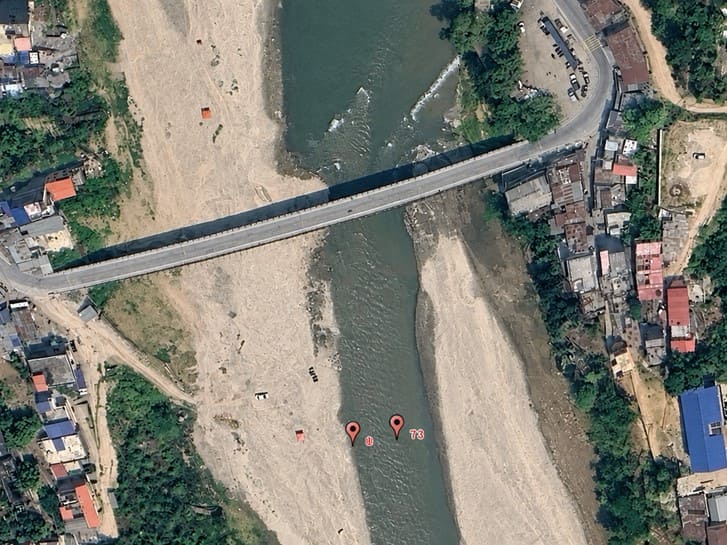
The measurement section sat about 100 meters downstream of the Dolalghat Bridge. The river runs roughly 20 meters wide there, with water less than a meter deep and a current reaching 2.6 meters per second at its fastest, averaging around 1 meter per second. Shallow and fast is an awkward combination. It is too shallow for a manned boat, fast enough to make wading unsafe, and wide enough that nothing can simply be handed across.
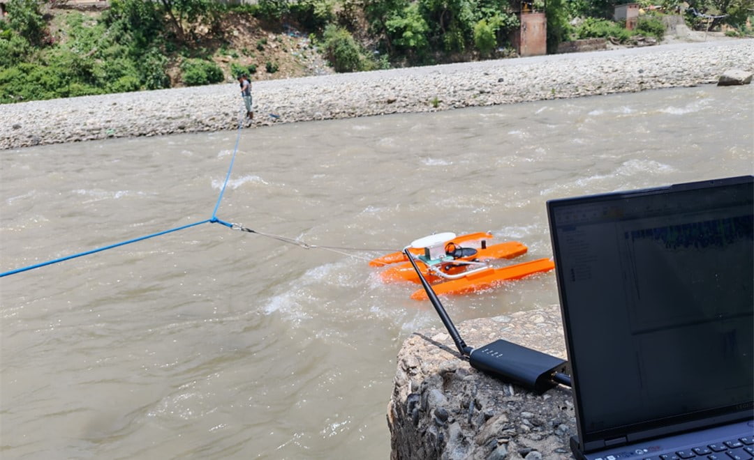
The original plan was to throw a rope across the channel and anchor it on the far bank. At 20 meters, with the current running, that did not work. Instead the team dropped the rope from the bridge deck and walked it down to the measurement section, then fixed the survey craft to the middle of the line so there was enough rope on either side for two people to tow from the banks. The craft was hand-towed across the section at a steady speed, which is what a cableway would have provided if the site had one.
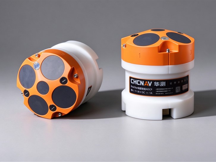
Two conditions at this site defeat a standard setup. The first is depth. An acoustic profiler does not measure the whole water column: a blanking distance below the transducer and a near-bed layer at the bottom are both unusable, and what is left is what gets profiled. In under a meter of water there is very little left. The RiverStar RS1200 ADCP was run in its shallow-water, high-velocity mode for exactly this reason, which shortens those unusable margins and keeps the sampling rate high enough to resolve a fast current.
The second condition is the riverbed itself. An acoustic profiler normally works out how fast it is traveling by bouncing sound off the bed and measuring the shift, which assumes the bed is holding still. In a fast reach carrying sediment, it is not. The bed material moves downstream with the current, the instrument reads its own speed across the ground as lower than it really is, and every velocity in the cross section is understated. Discharge comes out low, and nothing in the data looks wrong.
Referencing the craft's position externally, against satellite positioning rather than against the riverbed, removes the assumption and the error with it. On a river known to carry sediment it is the difference between a defensible number and a plausible one.
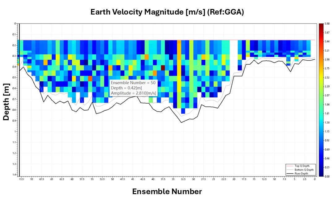
The measurement was completed in a single pass in under ten minutes. Data went to a laptop over a radio link, with no mains power and no internet needed at the site, and was checked and exported in HydroProfiler as a discharge table and a cross-section profile. Nobody entered the water.
Those two outputs are what a hydrology program actually works from. The discharge table gives the flow figure for the day and, repeated at different stages, builds the rating curve that turns a simple water level reading into a flow record for the rest of the year. The cross-section profile documents the channel shape the measurement was made in, which is what tells a later team whether the section has scoured or filled and whether the older readings still stand.
| Site parameter | Value |
|---|---|
| Location | Hutkesi River at Dolalghat, Nepal, about 100 m downstream of the bridge |
| River width | Approximately 20 m |
| Water depth | Less than 1 m |
| Flow velocity | 1 m/s average, 2.6 m/s maximum |
| Measurement time | Single pass, under 10 minutes |
| Deliverables | Discharge table and cross-section profile |
Rigging the rope was the hardest part of the day, and it is the part that does not scale. It worked here because three things happened to line up: a bridge directly upstream to drop the line from, a channel narrow enough that two people on opposite banks could hold the tension, and equipment light enough to be carried to the water by hand. Take away any one of them and the traverse has to come from somewhere else.
On a wider river, or one with no bridge to work from, the same approach would not be available, which is why the team discussed an unmanned, self-propelled flow measurement setup with the university group afterwards. A craft that holds its own line under power does not need the site to provide one. The wider point holds for any gauging program working at ungauged sites: the instrument is rarely the constraint, the way you get it across the section usually is. Our hydrographic surveying platforms cover both approaches, and the companion piece on the Chao Phraya discharge survey shows the same measurement on a large tidal river. For choosing between instrument types, our hydrographic survey equipment guide sets out where an ADCP fits against echo sounders and multibeam.
CHC Navigation (CHCNAV) develops advanced mapping, navigation, and positioning solutions designed to increase productivity and efficiency. Serving industries such as geospatial, agriculture, machine control and autonomy, CHCNAV delivers innovative technologies that empower professionals and drive industry advancement. With a global presence spanning over 140 countries and a team of more than 2,200 professionals, CHC Navigation is recognized as a leader in the geospatial industry and beyond. For more information about CHC Navigation [300627.SZ], please visit: https://geospatial.chcnav.com/about/overview
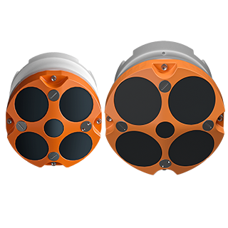
CHCNAV RS-1200 & RS-600
High Accuracy Acoustic Doppler Current Profiler







































.png)