10 Sept 2026
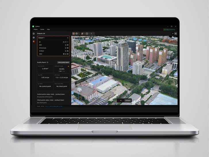
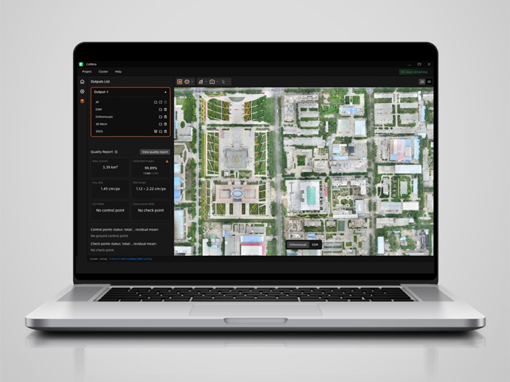
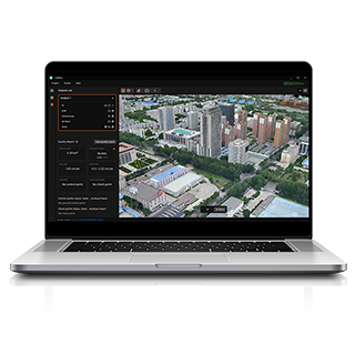
Shanghai, China, September 10, 2026. CHC Navigation (CHCNAV), a global provider of geospatial solutions, announced the launch of CHCNAV CoMeta, professional desktop software combining photogrammetry and native 3D Gaussian Splatting (3DGS) in one processing environment. The software transforms UAV and camera imagery with positioning and orientation data into georeferenced orthomosaics, digital surface models (DSMs), textured 3D meshes, and photorealistic 3DGS models.
CoMeta supports professional workflows in surveying and mapping, engineering, real-scene 3D mapping, infrastructure digitalization, and digital twins. By combining photogrammetric processing and native 3DGS, it allows users to produce both measurement-oriented geospatial deliverables and realistic 3D scenes from the same source imagery.
A single CoMeta project can process more than 100,000 images, reducing the need to manually divide large datasets and merge separate results. Distributed cluster processing across 15 or more computing nodes further expands capacity for wide-area and high-volume mapping projects.
Automated batch processing and dual-engine computation accelerate aerial triangulation, orthomosaic generation, and 3D mesh reconstruction. In benchmark datasets, CoMeta completed these end-to-end photogrammetry workflows approximately two to three times faster than the mainstream software configurations tested.
CoMeta processing capacity supports projects such as large-area aerial mapping, river and corridor surveys, engineering surveys, urban and rural 3D mapping, and other applications requiring extensive image datasets.
One aerial triangulation result can generate multiple professional outputs, including orthomosaics, DSMs, textured mesh models, and native 3D Gaussian Splatting models.
Orthomosaics, DSMs, and textured meshes support surveying, GIS production, engineering documentation, and spatial analysis. Native 3DGS adds photorealistic visualization for digital twins, infrastructure visualization, real-scene 3D mapping, and immersive presentation.
For visually complex elements such as water surfaces, glass facades, vegetation, and thin structures, CoMeta's 3DGS workflow can reduce manual model retouching time by more than 70% compared with the tested conventional mesh refinement workflow.
CoMeta works with imagery from different UAV and camera manufacturers rather than requiring a proprietary acquisition platform. Its built-in calibration database includes more than 400 camera profiles covering systems from DJI, Sony, Feima, RIY, Saier, and other manufacturers. Standard positioning and orientation data can be imported from different acquisition platforms, allowing users to process existing datasets and continue using established field equipment.
Results can be exported in commonly used formats including GeoTIFF, OBJ, PLY, OSGB, 3D Tiles, and LAS for integration with surveying, GIS, engineering, visualization, and digital twin software environments.
CHC Navigation (CHCNAV) develops advanced mapping, navigation, and positioning solutions designed to increase productivity and efficiency. Serving industries such as geospatial, agriculture, machine control, and autonomy, CHCNAV delivers innovative technologies that empower professionals and drive industry advancement. With a global presence spanning over 140 countries and a team of more than 2,200 professionals, CHC Navigation is recognized as a leader in the geospatial industry and beyond. For more information about CHC Navigation [300627.SZ], please visit: https://www.chcnav.com/about/overview
CHCNAV CoMeta
Professional Photogrammetry and 3DGS Software







































.png)