12 Aug 2026
At a busy railway crossing over the Huaihe River, a survey team needed to inspect the underwater foundations of the bridge piers, measure the scour and siltation around them, and map the riverbed upstream and downstream, all without putting a crewed boat into a heavily trafficked channel. They ran the survey with the CHC Navigation Apache 4 unmanned surface vessel carrying an HN-400M multibeam echosounder, and turned the soundings into a full three-dimensional picture of the riverbed. This is how the survey came together.
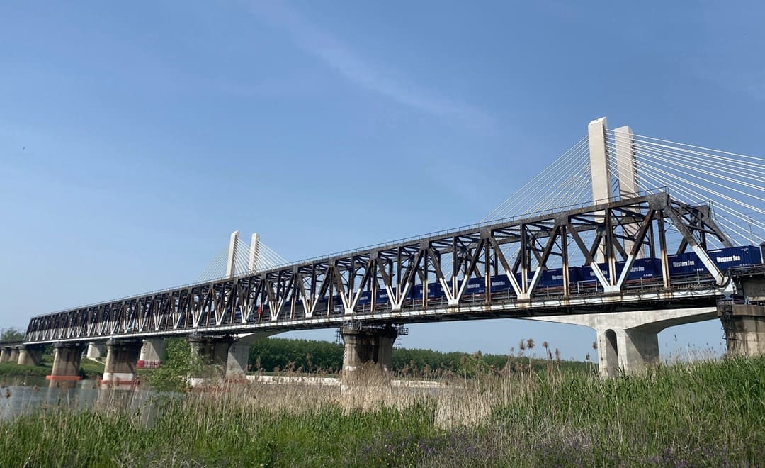
The survey area sits at the Huaihe River railway bridge in Bengbu, Anhui Province. The work had a clear brief: inspect the bridge piers below the waterline, measure the scour and siltation around each pier, and carry out a topographic survey of the riverbed upstream and downstream of the bridge. An accurate record of the riverbed shape across the whole span was needed to judge the condition of the foundations.
In this setting, running the survey from a manned vessel raised three problems:
What the team needed was a compact, highly maneuverable platform that could work safely in traffic, approach the piers closely, and launch from the bank without a dock.
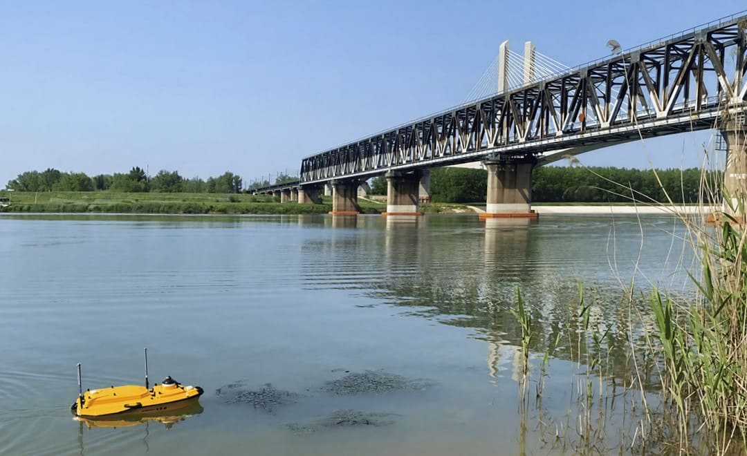
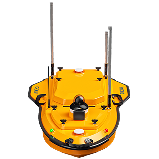
The team paired the Apache 4, a compact and purely electric unmanned surface vessel, with the HN-400M, a lightweight dual-frequency multibeam echosounder. The USV is small and highly maneuverable, so it can approach the bridge foundations closely to capture detailed data, and its compact design lets the team launch and survey from the bank with no dedicated dock. Millimeter-wave obstacle-avoidance radar lets the vessel steer clear of passing boats automatically, and on-board cameras let the operator watch the equipment in real time, so the survey runs safely in an active channel.
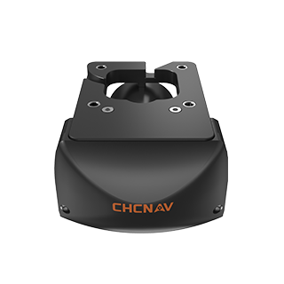
The HN-400M combines 400 kHz and 550 kHz operation with FM CHIRP, so the 550 kHz mode captures high-resolution detail in the shallows around the piers while 400 kHz improves penetration in deeper and more turbid water. A 0.03° integrated IMU provides real-time motion compensation, a 145° swath covers up to six times the water depth in a single pass, and at 3.5 kg the sensor is light enough for rapid USV deployment. Together the platform and sensor produce dense coverage of the riverbed, on the order of 5,000 points per square metre with point spacing under 0.03 m, rather than a set of single-point measurements.
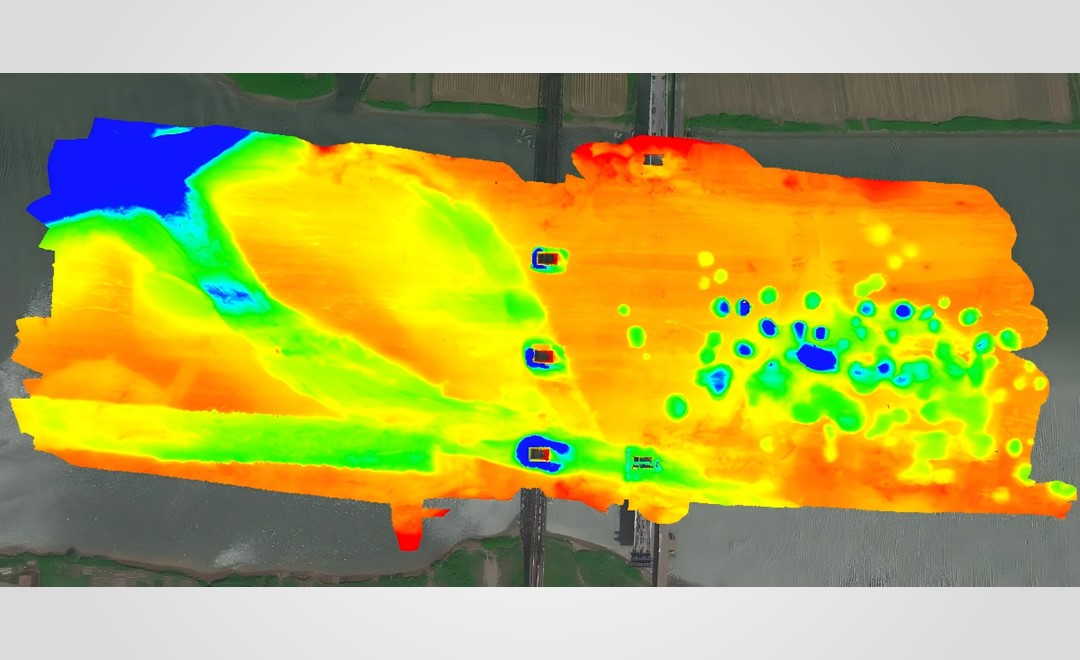
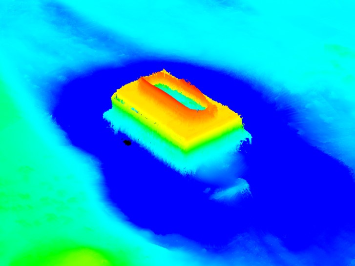
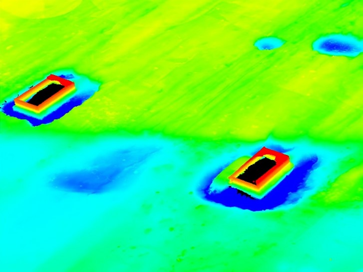
The workflow was straightforward. The team planned the survey lines based on the water depth of the area and let the Apache 4 run them autonomously, while the HN-400M recorded a continuous swath of soundings across the riverbed. The soundings were then output as a three-dimensional point cloud of the survey area, giving a full-coverage model of the bed and the structures on it.
From the three-dimensional point cloud, the survey delivered four types of result for the bridge and the channel:
The same approach carries across to other structural and channel work. It suits the underwater foundation inspection of highway and railway bridges, waterway maintenance and dredging surveys, and the inspection of port and dock structures, wherever detailed underwater data is needed in water that is busy, shallow near structures, or awkward for a crewed boat to reach.
| User pain point | Manned vessel | Apache 4 USV with HN‑400M |
|---|---|---|
| Working in vessel traffic | Navigation safety risk near the piers | Millimeter-wave radar avoids passing boats automatically |
| Getting close to the piers | Large boat cannot approach the foundations | Small, maneuverable platform works close in for detailed data |
| Launching on site | Needs a suitable dock | Compact and lightweight, launched from the bank |
| Coverage of the bed | Sparser single-point measurement | Dense multibeam swath, full three‑dimensional coverage |
| Equipment safety | Harder to monitor near structures | On‑board cameras give real‑time monitoring |
For teams planning inland and structural bathymetric surveys, the wider range of CHC Navigation marine surveying solutions covers USV platforms and multibeam payloads for hydrographic and bathymetric work.
CHC Navigation (CHCNAV) develops advanced mapping, navigation, and positioning solutions designed to increase productivity and efficiency. Serving industries such as geospatial, agriculture, machine control and autonomy, CHCNAV delivers innovative technologies that empower professionals and drive industry advancement. With a global presence spanning over 140 countries and a team of more than 2,200 professionals, CHC Navigation is recognized as a leader in the geospatial industry and beyond. For more information about CHC Navigation [Huace:300627.SZ], please visit: https://geospatial.chcnav.com/about/overview
CHCNAV APACHE 4
Hydrographic and Bathymetric Surveys USV
CHCNAV HN-400M
Multibeam Echosounder







































.png)