24 Jul 2026
Mobile mapping is the practice of capturing accurate 3D data while a sensor platform is moving, rather than measuring only from fixed survey points. Two approaches are commonly used today: ground-based mobile mapping systems mounted on a vehicle, trolley or backpack, and drone-based mapping systems flown over the site. Both can produce georeferenced 3D datasets, but they suit different environments, deliverables and operational constraints. This guide explains how each workflow works and how to choose between them.
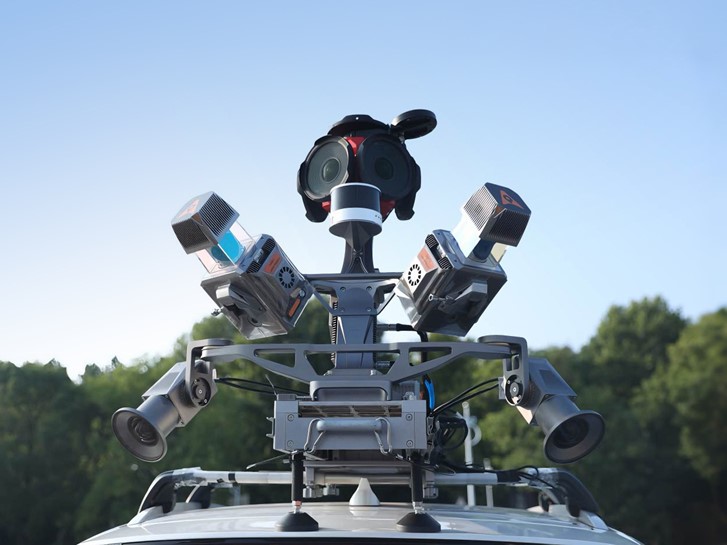
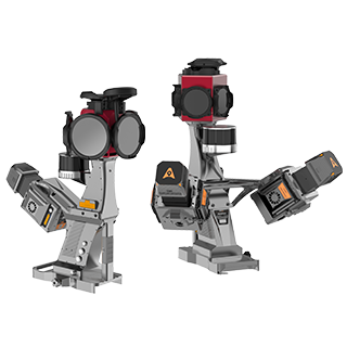
A mobile mapping system carries a positioning and sensing payload that records the environment continuously as the platform moves. In most professional systems, this payload combines a GNSS receiver, an inertial measurement unit, a LiDAR sensor or camera, and software that synchronises and processes the data into a georeferenced dataset. In GNSS-limited or indoor environments, additional methods such as SLAM, odometry or control points may also be used to support trajectory accuracy. Where a total station or a static laser scanner measures from one setup position, a mobile system maps a corridor or area in one continuous pass, which is what makes it efficient for large, linear or access-sensitive sites. The AU20 MMS is an example of a vehicle-mounted system designed for road surveying, infrastructure mapping and high-density 3D data capture.
Accuracy in a moving survey comes from combining several sources of positioning rather than relying on a single sensor. A GNSS receiver places the platform in a global coordinate frame, while real-time or post-processed corrections, such as RTK or PPK, improve the positioning solution. The inertial measurement unit tracks pitch, roll, heading and acceleration many times per second, helping maintain the trajectory when GNSS visibility is briefly reduced. On some ground-based systems, especially backpack, indoor, tunnel or urban workflows, SLAM can add another layer by matching LiDAR scans against the surrounding geometry. This helps estimate movement where GNSS is weak or unavailable, but it does not remove the need for good survey practice: sensor calibration, time synchronisation, loop closure, control points and trajectory quality checks still matter. The survey software brings these elements together into a trajectory, and every LiDAR point or image is then linked back to that trajectory, turning moving sensor data into a measurable, georeferenced dataset.
Ground-based systems capture the world from street level. Mounted on a car, survey vehicle, trolley or backpack, they record what a person or vehicle can see: road surfaces, kerbs, facades, signage, utilities, rail assets, tunnels and vertical structures. Because the sensor often passes close to these features, the resulting point cloud can be dense and detailed, which makes ground-based mobile mapping well suited to road and rail corridors, urban surveys, asset inventories, tunnels and indoor spaces.
Ground platforms can also be effective where aerial access is limited or where vertical detail is the priority. In urban canyons, under tree cover or inside tunnels, GNSS may be degraded or unavailable, so the system must rely more heavily on the IMU, SLAM, odometry and post-processing controls. These methods can support continuity, but their performance depends on the environment, trajectory length, feature geometry and processing workflow. The trade-off is line of sight and access: a ground system maps what it can drive or walk past, so rooftops, inaccessible land, open terrain away from the route and closed sites may be harder to capture from the ground alone.
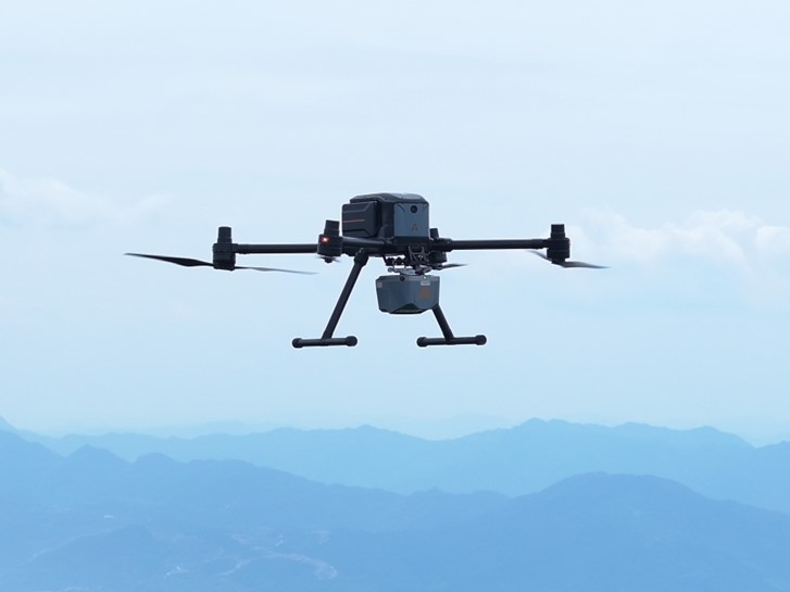
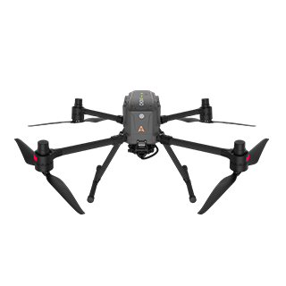
Drone-based mapping changes the viewpoint by capturing the site from above. A survey drone flies a planned mission over the area and collects imagery, LiDAR data, or both. This makes it a strong choice for large areas, open terrain, quarries, stockpiles, farmland, earthworks and sites that are unsafe or difficult to walk. A platform such as the X500 drone can cover areas that would take a ground crew much longer to access directly.
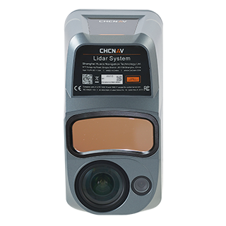
Payload choice determines the type of data produced. A camera supports photogrammetry, orthophotos, textured models and image-derived point clouds. A UAV LiDAR payload such as the AlphaAir 10 UAV LiDAR measures distance directly and can capture multiple returns from vegetation and ground surfaces, helping teams model bare-earth terrain more effectively than imagery alone. Drone mapping is strongest where the survey needs broad area coverage and a top-down view. It is less effective for surfaces hidden from above, such as building facades, underside structures, dense vertical assets, or areas below heavy canopy where few laser returns reach the ground.
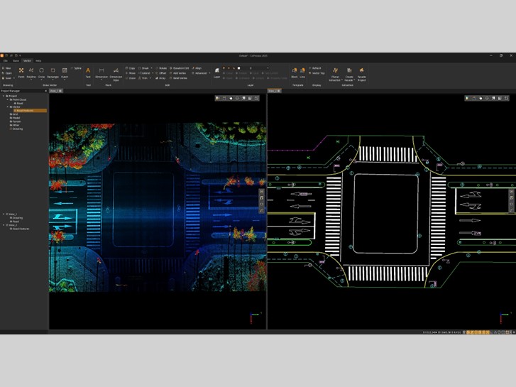
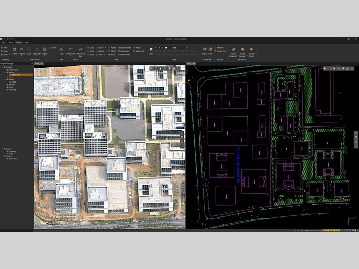
Whichever platform captures the data, the output is a georeferenced 3D dataset that can be turned into several deliverables. The core product is often a point cloud, a dense set of measured or computed points representing visible surfaces. From there, teams can derive orthophotos, scaled maps, digital elevation models, digital terrain models, contour lines, cross sections, asset inventories and 3D models for design or inspection.
Because the data is tied to a coordinate reference system, ground and aerial datasets can often be combined into a more complete model. Repeat surveys can also be compared to detect change, measure volumes, monitor construction progress or update infrastructure records. The platform shapes what is easiest to extract: a ground-based system is strongest on close-range vertical detail such as facades, tunnels, roadside assets and rail corridors, while an aerial survey is stronger on wide-area terrain, open surfaces, rooftops, stockpiles and areas that are difficult or unsafe to access on foot.
| Consideration | Ground-based MMS | Drone-based mapping |
|---|---|---|
| Viewpoint | Street level, close to features | Aerial, top down |
| Best for | Roads, rail, urban corridors, tunnels, indoors, asset inventories | Large areas, open terrain, quarries, stockpiles, farmland, inaccessible sites |
| Vertical detail | Strong on facades, roadside assets, tunnels and close-range structures | Strong on terrain, roofs, stockpiles and surface models, weaker on facades |
| GNSS-limited sites | Can use IMU, SLAM, odometry and control points, depending on the system | Needs suitable open-sky conditions for professional GNSS-supported flight and georeferencing |
| Coverage speed | Fast along a route or corridor | Fast across a wide open area |
| Access | Limited to drivable or walkable paths | Reaches closed or unsafe ground from the air |
The decision usually comes down to the shape of the site, the required deliverables and where the detail is needed. Choose a ground-based mobile mapping system when the target is a corridor or built environment, when facades and roadside assets matter, or when the survey must capture details from street level. It is also a strong option for tunnels, indoor spaces and routes where repeated asset mapping is required.
Choose a drone-based workflow when the site is large or open, when access is difficult or unsafe, or when you need broad terrain coverage from above. Drone LiDAR can also be valuable where vegetation is present and the project requires terrain modelling beneath partial canopy.
On many projects, the two workflows are complementary rather than competing. A drone can capture the wider terrain, rooftops and open areas, while a ground-based system fills in streets, facades, tunnels and details below overhangs or cover. When both datasets are processed in the same coordinate frame, they can be merged into a more complete 3D model. Choosing the right mix is where an experienced survey team adds the most value.
Mobile mapping is the broad practice of capturing geospatial data while the sensor platform is moving. Ground-based mobile mapping is carried by a vehicle, trolley or backpack. Drone mapping is an aerial workflow that uses UAV imagery, LiDAR, or both. Both can produce georeferenced 3D data, but they capture the site from different viewpoints.
Neither workflow is automatically more accurate. Accuracy depends on the sensor payload, GNSS correction method, IMU quality, calibration, control points, processing workflow, flight or driving conditions and the required deliverable. Ground systems often capture close-range detail on streets and structures, while drones cover wide or difficult areas from above. Many projects use both.
Ground-based mobile mapping can continue through short or controlled GNSS outages using the IMU, SLAM, odometry and control points, depending on the system and environment. However, accuracy must still be checked through proper processing and quality control. Professional drone mapping generally requires suitable GNSS conditions for flight navigation and accurate georeferencing.
To see the platforms and payloads behind both approaches, explore the CHC Navigation 3D mobile mapping and reality capture solutions.
CHC Navigation (CHCNAV) develops advanced mapping, navigation, and positioning solutions designed to increase productivity and efficiency. Serving industries such as geospatial, agriculture, machine control and autonomy, CHCNAV delivers innovative technologies that empower professionals and drive industry advancement. With a global presence spanning over 140 countries and a team of more than 2,200 professionals, CHC Navigation is recognized as a leader in the geospatial industry and beyond. For more information about CHC Navigation [Huace:300627.SZ], please visit: https://geospatial.chcnav.com/about/overview
CHCNAV AU20 MMS
High-End Mobile Mapping System
CHCNAV X500
Professional Multirotor Drone
CHCNAV AlphaAir 10
Professional Airborne LiDAR+RGB System
CHCNAV CoProcess
Point Cloud Processing Software for Scan-to-CAD and Terrain Modeling







































.png)