28 Aug 2026
Nobody starts this decision by picking a scanning technology. A project turns up first: an occupied building that has to be modelled before a refurbishment, a rail corridor that has to be checked between possessions, a stockpile that has to be measured before month end.
The scanner is the tool that gets that job done to the tolerance the contract asks for, in the time available.
The right scanner is not necessarily the one with the highest range, the densest point cloud, or the lowest quoted accuracy figure. It is a system that produces reliable data for the required deliverable under the actual conditions of the project.
So this guide is organized the way the decision actually happens. It starts from the type of project and the deliverable it produces, points each one at the solution that suits it, and only then compares the platforms and the specifications.
If you want the underlying technology explained first, our guide to how LiDAR technology works covers the physics; this article assumes it and concentrates on the choice.
Write down what leaves your office at the end of the job. An as-built model of a plant room, a floor plan, a volume figure for a stockpile, a clash check against a design, a topographic surface, a heritage record. That single sentence sets the accuracy you need, the density you need, and, just as important, the density you do not need.
The reason this comes first is that scanning specifications are open-ended. Many scanners can produce dense point clouds. Very few projects need them. A floor plan needs geometry that survives being flattened into 2D lines. A clash check needs the pipe run in the right place to within a tolerance the engineer has already written down. Deciding on the deliverable converts an open comparison into a bounded one, and a bounded comparison usually has an obvious answer.
The key question is not "Which scanner collects the most data?" but "Which system produces the information required by the project, at the required accuracy, with acceptable field and processing effort?"
These are the application scenarios that account for most 3D mapping work, with the deliverable each one produces and the platform that suits it. Find the row closest to your project and the shortlist is already down to one or two systems.
| Application scenario | What you hand over | Platform that fits | CHCNAV systems |
|---|---|---|---|
| Indoor mapping and as-built documentation | Point clouds and floor plans of interiors, plant rooms and confined spaces | Handheld SLAM, where speed, access and coverage are priorities | RS7, RS10 |
| Scan to BIM and smart construction | Model-ready point cloud for clash detection, verification and digital twins | Handheld SLAM, tripod where the tolerance is tight | RS10, RS7 |
| Railway inspection and corridor mapping | Point cloud along a linear asset, repeatable between visits | Vehicle-mounted, UAV over sections with no road access | AlphaUni 20, AlphaAir 10 |
| Infrastructure construction | Topographic surface and structural detail for design and progress checks | UAV LiDAR, vehicle-mounted along the route | AlphaAir 10 on X500, AlphaUni 20 |
| Mining and terrain monitoring | Volumes, slope surfaces, and change between one visit and the next | UAV LiDAR, handheld for faces and underground | AlphaAir 6, AlphaAir 15 Pro, RS10 |
| Forestry and environmental management | Canopy height, biomass estimates, ground surface under vegetation | UAV LiDAR, flown high enough to cover the block | AlphaAir 15 Pro, AlphaAir 6 |
| Utility and asset management | Positioned asset inventory along networks, indoors and out | Vehicle-mounted outdoors, handheld inside plant | AlphaUni 20, RS10 |
The full description of each scenario, with the workflows and the software behind them, is on the 3D mobile mapping and reality capture solutions page. What follows here is the part that page does not cover: how to tell which one you are actually in, and what to check before you commit.
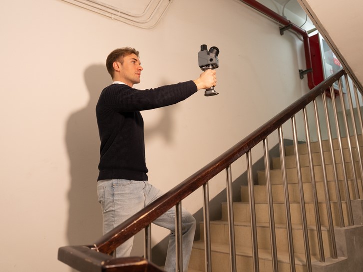
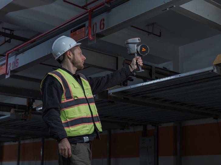
Interiors are the case where the scanning method is decided by the building rather than by the specification. A tripod has to be set up, moved and set up again in every room, and in an occupied building that is a week of getting in people's way. A handheld SLAM scanner is walked through the space instead, which is why a floor that takes a day of occupations takes an hour, and why stairwells, risers and plant rooms get covered rather than skipped.
The deliverable is usually an as-built record: a point cloud for renovation planning, facility management or a Scan-to-BIM workflow. Where the work is entirely indoors, the RS7 is the closer fit. Where the same job runs in and out of the building, the RS10 adds GNSS RTK, so the walked trajectory stays tied to a known framework outside and holds on SLAM alone once you are inside.
The question here is not coverage but tolerance. A BIM model built for clash detection has a tolerance written into it by the engineer, and that number decides whether a walked trajectory is good enough or whether the critical areas need static occupations as well. In practice many projects do both: handheld for the volume of the building, tripod for the few places where a clash would be expensive.
This hybrid approach is often more efficient than applying the highest-accuracy scanning method to every part of the project.
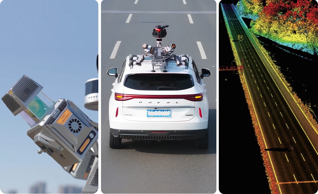
Linear sites are the one case where the length of the job becomes an advantage rather than a cost, provided the platform can keep moving. A road, a rail corridor or a tunnel captured in a single pass at driving speed is throughput no other method approaches, and a multi-platform system such as the AlphaUni 20 (AU20) is built for it, including the ability to move between vehicle and airborne use on the same project.
The limits are worth knowing before you commit. You get what is visible from the road, the platform has to be able to get there, and the accuracy rests on the positioning and inertial solution rather than on the scanner alone. Sections with no vehicle access are usually the reason a corridor project ends up flying part of the route as well.
The choice is therefore not always vehicle versus airborne. Many large corridor projects combine multiple platforms depending on access, safety requirements and the final deliverable.
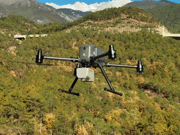
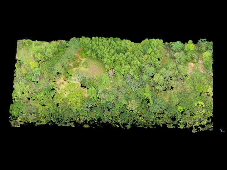
Open sites are decided by area and by what is in the way. For larger open areas, UAV LiDAR is often the most efficient method, especially when terrain, vegetation or access conditions make ground survey inefficient. Over vegetation, LiDAR has an advantage because laser pulses can often recover ground information where optical methods struggle. That is what makes the same platform serve both stockpile volumes and biomass assessment.
The choice within the airborne range is a question of block size and flying height rather than of accuracy: the AlphaAir 6 suits routine site and terrain work, and the AlphaAir 15 Pro is the long-range option when the block is large enough that flying it lower would take too many sorties. Both need the operating envelope around them: flight planning, permissions, weather, and a minimum project size below which the economics do not work.
Once you know which scenario you are in, four questions decide which system inside it:
How big is the site, and how is it laid out? The distinction that matters is not area but shape: linear sites reward a scanner that keeps moving, contained sites reward one that stays still.
What is the access like? Can you set up a tripod repeatedly, or is the site live, congested or unsafe to stand in for long? Is there sky above you for GNSS, or are you indoors, under canopy, or underground?
What tolerance is written into the contract? Not the tolerance you would like. The one that will be checked. Millimeter work on a machine foundation and centimeter work on a road corridor are different purchases.
Who processes the data, and how much time do they have? This is the question most often skipped, and it is usually the one that decides whether a scanner was a good buy. A method that saves an hour in the field and adds a day in the office is not a saving.
The same information from the other direction, for readers who already know which platform they are considering and want to see what it costs them.
| Platform | Where it wins | What it costs you |
|---|---|---|
| Tripod-based scanning | The accuracy benchmark. The instrument is static, so the measurement is not competing with motion, and on contained sites with clear lines of sight it produces the tightest results available. | Time and repetition. Every occupation has to be set up, scanned and later registered to its neighbours, and on a complex site the number of occupations grows faster than people expect. |
| Handheld SLAM scanning | Coverage. The operator walks the site and the scanner builds its position as it goes, including the awkward interior spaces a tripod cannot reach cleanly. | Accuracy now depends on trajectory quality, which depends on the environment: featureless corridors and long straight tunnels give a SLAM solution little to hold on to. Combining SLAM with GNSS RTK where sky is available is the practical answer. |
| Vehicle-mounted scanning | Throughput on linear assets. A road, a rail corridor or a tunnel is captured in a single pass at driving speed. | You get what is visible from the road, the platform has to be able to get there, and the accuracy rests on the positioning and inertial solution rather than on the scanner alone. |
| Airborne scanning | Ground that nothing else can reach, and returns through vegetation that no other method matches. | The whole operating envelope: flight planning, permissions, weather, and a minimum project size below which it makes no economic sense. |
Most organizations that scan regularly end up with two of these rather than one, because the trade-offs are genuine and no single platform absorbs every scenario in the first table.
No single platform is optimal for every combination of accuracy, coverage, access and cost.
Specification accuracy is measured under conditions your project will not reproduce. It is a real number and a useful one for comparison, but it describes a single measurement to a cooperative surface at a stated range in controlled conditions. The figure that decides whether your deliverable passes is different, and it accumulates from four places.
The ranging measurement itself, which is what the specification quotes. The registration that ties separate scans or a walked trajectory into one coordinate system, which for many projects contributes more error than the ranging does. The georeferencing that ties the whole cloud to real-world coordinates, which is where GNSS quality and control points matter. And the surface itself, since dark, wet, glossy and grazing-angle surfaces all return less signal than the test target used for the specification.
The practical consequence: when comparing two scanners with similar quoted accuracy, the more useful question is which one gives you a defensible record of the other three. A system that reports its trajectory quality and lets you check it against control is worth more on a project that will be audited than one with a slightly better headline figure.
Processing time. Ask how long a representative dataset takes from download to deliverable, on hardware you already own. Ask to see it rather than be told it.
Software. Whether processing is included or licensed separately, and whether the export formats drop into the software your clients actually use without a conversion step that loses information.
Corrections. Any method that relies on GNSS relies on a correction source, whether that is a local base, a network service or satellite-delivered corrections. That is an operating cost and, in some regions, an availability question.
Training and staff time. Handheld methods are quick to learn to operate and take longer to learn to operate well; the difference shows up in the point cloud, in the form of coverage gaps found after the crew has left site.
Data storage. Full-density point clouds accumulate quickly, and the archive is often a contractual obligation rather than a choice.
A building refurbishment, four floors, occupied. The deliverable is an as-built model for design coordination. The site is contained, the access is awkward, the tolerance is centimeter-level, and the building cannot be closed. Handheld SLAM is the fit: the coverage is complete, the crew is not obstructing the occupants for a week, and the tolerance is well within reach.
A 30 km road corridor for a resurfacing design. The deliverable is a surface model along a linear asset with open sky. Vehicle-mounted scanning is the fit, because it is the only method that turns the length of the site into an advantage rather than a cost.
A machine foundation acceptance survey. The deliverable is a small number of measurements to a tight tolerance, and it will be checked. Tripod-based scanning, or in some cases a total station rather than a scanner at all, is the fit. This is the case where the highest-throughput method is the wrong answer.
Ask for a demonstration on a site like yours rather than a showroom, and ask for the raw data from it, not only the finished figure. Ask what the accuracy is when the trajectory is poor rather than when it is good, because that is the case that will decide a disputed deliverable. Ask what the workflow looks like when something goes wrong on site, and how quickly a crew can tell. Ask who supports the software as well as the hardware, and where from.
A 3D laser scanner is a production tool rather than a purchase, and the right one is the one that fits the project, the site and the office behind it. If you are weighing up specific systems, the CHC Navigation LiDAR and 3D scanning range covers handheld, vehicle-mounted and airborne platforms, and our note on reality capture explains what happens to the point cloud once the scanning is done.
CHC Navigation (CHCNAV) develops advanced mapping, navigation, and positioning solutions designed to increase productivity and efficiency. Serving industries such as geospatial, agriculture, machine control and autonomy, CHCNAV delivers innovative technologies that empower professionals and drive industry advancement. With a global presence spanning over 140 countries and a team of more than 2,200 professionals, CHC Navigation is recognized as a leader in the geospatial industry and beyond. For more information about CHC Navigation [300627.SZ], please visit: https://geospatial.chcnav.com/about/overview
Have a question about our solutions or dealership opportunities?






































.png)