31 Jul 2026
Shanghai, China, July 31, 2026. CHC Navigation (CHCNAV), a global provider of mapping, navigation, and positioning solutions, today announced the launch of CHCNAV PointX, an integrated high-precision positioning infrastructure that brings together the PointNet network RTK correction service and the PointSky satellite-based GNSS correction service.
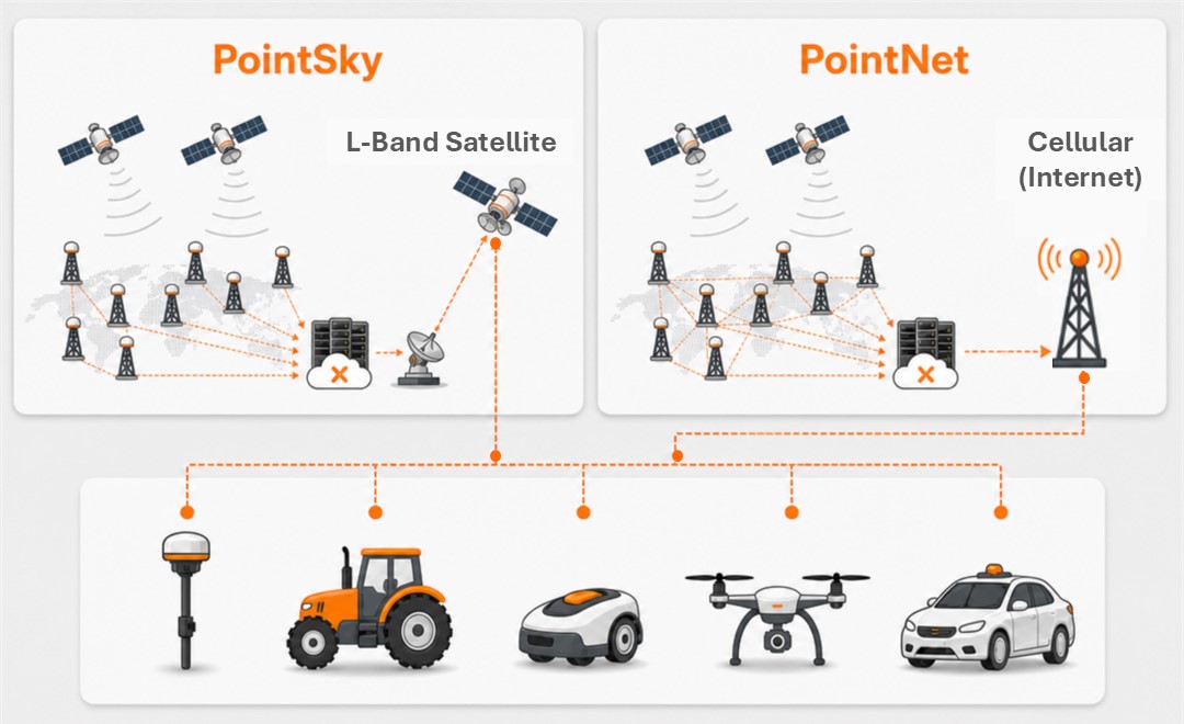
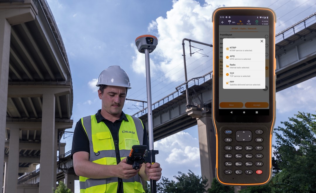
PointX is designed to deliver centimeter-level positioning across connected, remote, and infrastructure-limited operating environments. PointNet provides internet-based NRTK corrections through regional GNSS reference networks using the NTRIP protocol, while PointSky broadcasts PPP-based corrections via L-band satellite delivery. Compatible CHCNAV devices can access the correction service that best matches local connectivity, correction coverage, and project requirements.
“Reliable high-precision positioning should not depend on a single correction method or communication environment,” said George Zhao, CEO of CHC Navigation. “PointX brings together our ground-based NRTK infrastructure and satellite-based correction capabilities within one positioning infrastructure. By combining PointNet and PointSky, we are enabling users and technology partners to access centimeter-level positioning across connected, remote, and infrastructure-limited environments. This approach supports more consistent field operations today while providing a scalable foundation for surveying, construction, mapping, agriculture, and autonomous systems.”
Field teams do not always work under the same connectivity conditions. Urban and developed project areas may provide reliable internet or cellular access to network RTK services, while remote, offshore, agricultural, or infrastructure sites may have limited connectivity.
PointX addresses these different requirements through two complementary GNSS correction services:
This dual-service approach gives users greater flexibility when selecting a correction method for daily fieldwork, large-area projects, and operations that move between connected and remote locations.
PointNet is an internet-based network RTK correction service for surveying, mapping, construction, precision agriculture, and other high-accuracy applications. Field devices connect to the service through NTRIP over internet or cellular networks, reducing the need to install and maintain a local GNSS base station or radio link.
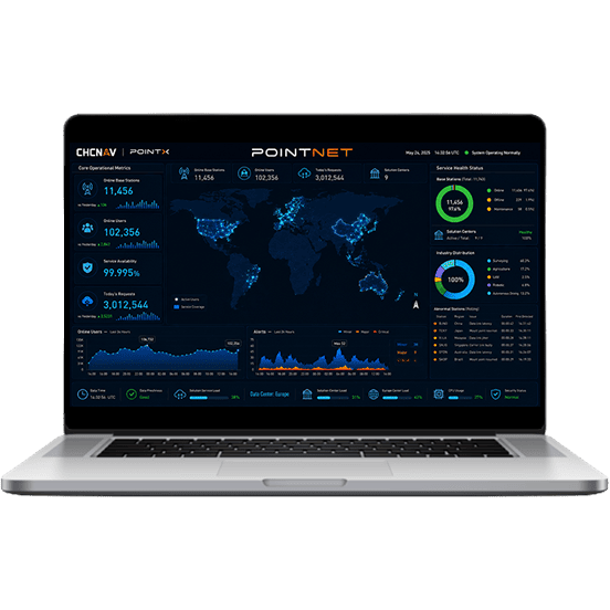
The PointNet infrastructure is supported by more than 10,000 GNSS reference stations. More than 99.5% of these stations provide full-constellation and full-frequency GNSS data, supporting stable correction generation across covered service regions.
PointNet’s scalable microservice-based infrastructure supports large numbers of simultaneous users, while 24-hour system monitoring and redundant cloud backups help maintain service availability of at least 99.99%. Compatible CHCNAV receivers, modules, and positioning terminals provide direct access to PointNet services.
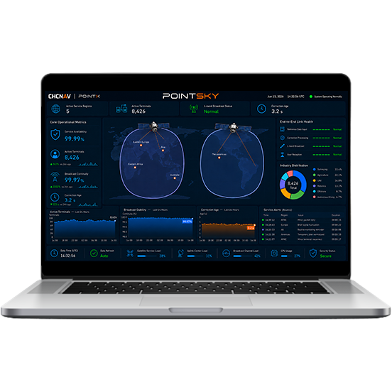
PointSky is an L-band satellite-based GNSS correction service designed for professional field operations beyond reliable network RTK coverage. Corrections are broadcast through geostationary satellites and received directly by compatible CHCNAV GNSS devices. This delivery method enables high-accuracy positioning without a local base station, radio link, cellular connection, or NTRIP service. It is particularly suited to remote surveying sites, offshore environments, large farms, infrastructure corridors, and projects spread across multiple locations.
Full accuracy is typically reached within 1 to 5 minutes. In selected enhanced service regions, convergence can be achieved in less than 1 minute, allowing users to begin high-accuracy data collection more quickly.
PointNet and PointSky are available for compatible CHCNAV receivers, modules, and positioning terminals through CHC Navigation and authorized partners. Service availability, accuracy, convergence performance, and supported features may vary according to region, device model, subscription, satellite visibility, network connectivity, and operating conditions.
CHC Navigation (CHCNAV) develops advanced mapping, navigation, and positioning solutions designed to increase productivity and efficiency. Serving industries such as geospatial, agriculture, machine control, and autonomy, CHCNAV delivers innovative technologies that empower professionals and drive industry advancement. With a global presence spanning over 140 countries and a team of more than 2,200 professionals, CHC Navigation is recognized as a leader in the geospatial industry and beyond. For more information about CHC Navigation [Huace:300627.SZ], please visit: https://www.chcnav.com/about/overview
CHCNAV PointSky
Satellite-Based GNSS Correction Service
CHCNAV PointNet
GNSS NRTK Correction Service







































.png)