11 Aug 2026
Shanghai, China, August 11, 2026. CHC Navigation (CHCNAV), a global provider of geospatial solutions, announced the launch of the CHCNAV S100 HawkEye Camera, a long-range 4K imaging system designed to add real-time visual verification to slope stability and deformation monitoring. Integrated with the CHCNAV PS-2000 GeoSAR system and MAS monitoring software, the S100 automatically connects monitoring alarms with live imagery of the corresponding risk area, helping operators verify events and assess site conditions more quickly.
Designed for professional geotechnical monitoring, the S100 provides visual context alongside radar deformation data over monitoring distances of up to 5 km. Typical applications include open-pit mine slope monitoring, tailings dams, landslides, reservoir dams, infrastructure slopes, and emergency response operations.
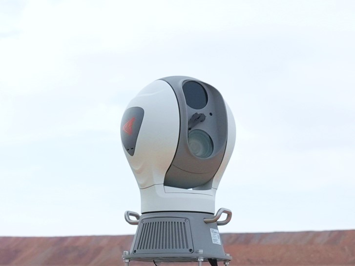
The S100 combines 4K visible-light imaging with 8 million effective pixels and 40x optical zoom to support remote inspection over distances up to 5 km. Monitoring teams can examine slopes and other monitored areas in detail from a safe observation point, reducing the need for personnel to approach inaccessible or potentially hazardous locations. Its long-range imaging capability provides operators with direct visual information when interpreting deformation data, helping them identify surface conditions, inspect areas of interest, and better understand events detected by the monitoring system.
The S100 uses a high-precision pan-tilt system with continuous 360° horizontal rotation and vertical movement from +90° to -90°. With preset positioning accuracy of less than 0.1°, the camera can repeatedly return to specific monitoring locations. This flexibility enables one fixed camera installation to cover multiple areas across large slopes. Operators can remotely move between predefined observation points or direct the camera toward areas requiring closer inspection without repositioning the system in the field.
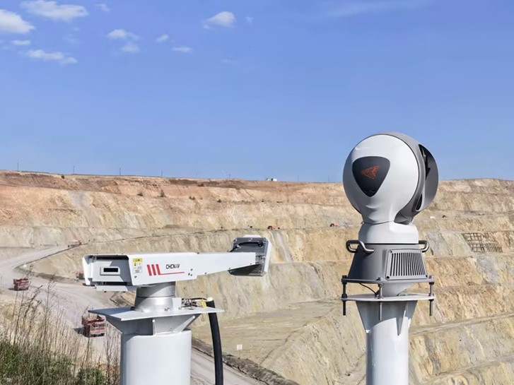
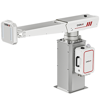
The S100 is designed to operate as the visual verification layer of the CHCNAV PS-2000 slope monitoring solution. When the PS-2000 detects displacement that exceeds a defined monitoring threshold, CHCNAV MAS identifies the alarm location within the monitored scene and automatically directs the S100 toward the corresponding area. The camera then provides a live 4K view of the alarm zone, allowing monitoring teams to compare radar deformation data with current site conditions. The automatic radar-to-camera workflow can reduce the time required to locate and visually verify an alarm, supporting faster assessment and response. Under supported operating conditions, the integrated workflow can reduce alarm verification time from hours to as little as five minutes.
Please visit the PS-2000 product page for more information about the S100 HawkEye Camera and its integration with the PS-2000 GeoSAR slope monitoring solution: https://geospatial.chcnav.com/products/chcnav-PS-2000
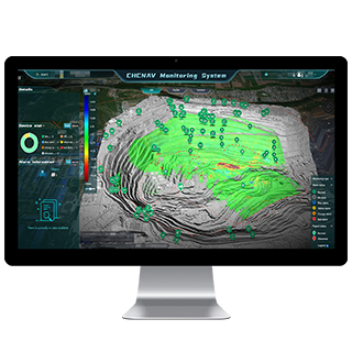
CHCNAV MAS brings S100 imagery together with PS-2000 GeoSAR measurements, DEM data, and other monitoring information in a unified monitoring environment. Panoramic data fusion links visual information with corresponding deformation locations, giving operators additional spatial context when reviewing alarms and changes across a monitored slope. By combining quantitative radar measurements with remote visual inspection, monitoring teams can more efficiently assess areas of concern, verify detected events, and support more informed geotechnical risk management. Together, the S100 HawkEye Camera, PS-2000 GeoSAR, and MAS software provide an integrated CHCNAV slope monitoring workflow covering deformation detection, alarm localization, visual verification, data interpretation, and response.
CHC Navigation (CHCNAV) develops advanced mapping, navigation, and positioning solutions designed to increase productivity and efficiency. Serving industries such as geospatial, agriculture, machine control, and autonomy, CHCNAV delivers innovative technologies that empower professionals and drive industry advancement. With a global presence spanning over 140 countries and a team of more than 2,200 professionals, CHC Navigation is recognized as a leader in the geospatial industry and beyond. For more information about CHC Navigation [Huace:300627.SZ], please visit: https://geospatial.chcnav.com/about/overview
CHCNAV PS-2000
Multi-Point Deformation Monitoring System
CHCNAV MAS
Cloud-Based Monitoring and Alarm Platform







































.png)






















.png)