CHCNAV Introduces AlphaAir 15 Pro Airborne LiDAR System for Large-Scale Geospatial Mapping
2026-06-10
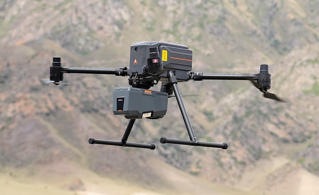
Shanghai, China, June 10, 2026 — CHC Navigation (CHCNAV), a global provider of geospatial solutions, announced the launch of the AlphaAir 15 Pro (AA15P), a premium airborne LiDAR system designed for large-scale geospatial mapping, high-density point cloud capture, and aerial survey operations in complex terrain. Developed for wide-area data acquisition, the AA15P combines ultra-long-range laser scanning, a high-precision positioning and orientation system, and flexible platform integration. With a measurement range of up to 3,200 m, the system supports efficient topographic LiDAR mapping, corridor mapping, terrain modeling, and engineering survey projects in areas with major elevation changes.
X500 UAV equipped with the AlphaAir 15 Pro LiDAR system for large-scale aerial mapping.
Long-range airborne LiDAR for high-altitude mapping
The AlphaAir 15 Pro is equipped with an extended-range laser core that supports measurement distances up to 3,200 m. Its long-range capability allows survey teams to collect aerial LiDAR data from higher flight altitudes and improve operational efficiency across large project areas. The AA15P is designed for demanding mapping environments, including mountains, valleys, forested areas, transportation corridors, and wide-area infrastructure projects. Its typical operating altitude range of 500 to 1,200 m AGL reduces flight line requirements while maintaining reliable point cloud acquisition over complex terrain.
High-precision positioning and orientation for reliable survey data
Accurate airborne laser scanning depends on stable trajectory data. The AA15P integrates a high-performance positioning and orientation solution with a 600 Hz IMU update rate. It delivers post-processed attitude accuracy of 0.005 degrees RMS for pitch and roll, and 0.010 degrees RMS for heading. Its high-precision POS architecture supports consistent georeferencing and maintains data quality during large-area aerial LiDAR surveys, especially where terrain variation, aircraft motion, and long flight lines can influence data accuracy.
High-density point cloud capture and vegetation penetration
The AA15P supports a maximum measurement rate of 2.4 million points per second, enabling dense point cloud capture for topographic mapping and engineering applications. Its laser design uses a concentrated beam and increased pulse energy to enhance vegetation penetration, allowing the system to detect ground surfaces under dense canopy. The system also includes an advanced multi-period processing algorithm supporting up to 12 zones for continuous point cloud acquisition at high pulse repetition rates while maintaining data completeness across demanding flight conditions.
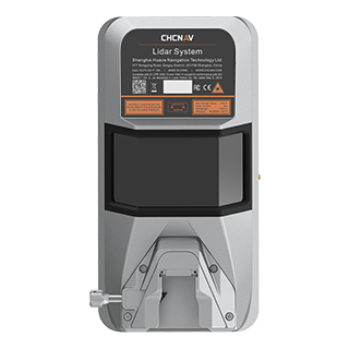
Compact payload for UAV and manned aircraft deployment
The AA15P features a compact architecture measuring 245 × 131 × 159 mm and weighing 2.6 kg without cameras. It can be deployed on large fixed-wing UAVs and manned aircraft, providing greater operational flexibility. With an optional streamlined airborne pod configuration, the system can support coverage of up to 60 square kilometers per hour when flying at 600 m AGL, accelerating large-area LiDAR data acquisition in a single flight.
____
About CHC Navigation
CHC Navigation (CHCNAV) develops advanced mapping, navigation, and positioning solutions designed to increase productivity and efficiency. Serving industries such as geospatial, agriculture, machine control, and autonomy, CHCNAV delivers innovative technologies that empower professionals and drive industry advancement. With a global presence spanning over 140 countries and a team of more than 2,200 professionals, CHC Navigation is recognized as a leader in the geospatial industry and beyond. For more information about CHC Navigation [Huace:300627.SZ], please visit: https://www.chcnav.com/about/overview