9 Jul 2026
Airborne LiDAR teams know the cost of a fragmented survey workflow. Hardware and software sourced from different manufacturers, multiple bolts, cables and connections at the aircraft, data downloaded from three devices in three formats, and range limits that leave gaps over complex terrain. On a recent corridor survey in Namibia, Strydom & Associates Land Surveyors replaced that model with a single connected workflow built around the CHCNAV AlphaAir 15 Pro (AA15P). The team captured a 70 km pipeline corridor in two days, processed and exported the data by the end of the following day, and delivered an average point density of around 80 points per square metre.
Strydom & Associates Land Surveyors is a professional land surveying company based in Windhoek, Namibia. Established in 1993, the company specialises in cadastral surveying, engineering surveys, topographic mapping, airborne LiDAR, photogrammetry and large-scale corridor mapping. For this project, the team flew an aerial LiDAR corridor survey for a proposed pipeline route in the Tumas mining area on the western coast of Namibia, south of the existing Bannerman and Langer Heinrich pipelines.
The brief set clear targets across length, accuracy and turnaround:
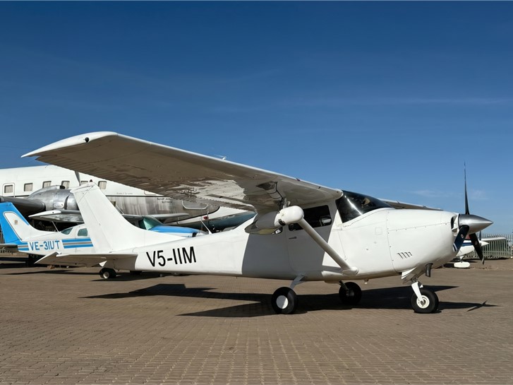
The AA15P replaced a multi-vendor toolchain with a single ecosystem that runs from flight planning to final CAD-ready deliverables. Mounted to a Cessna 182 aircraft flying at 150 km/h, the system pairs the airborne LiDAR sensor with a high-resolution medium-format camera and a tool-free mount, all driven by one software suite.
| Item | Product and details |
|---|---|
| Aircraft platform | Cessna 182, flying at 150 km/h for high efficiency |
| LiDAR system | CHCNAV AA15P airborne LiDAR system: 3200 m max range, 2400 kHz max pulse repetition rate, 600 Hz IMU update rate |
| Camera and imaging | R10ProS, 100 MP medium-format sensor (43.8 × 32.8 mm) with a 50 mm lens |
| Mounting system | Alpha Mount wing-strut installation with a tool-free quick-release design |
| Planning and flight software | BortBiZ-Plan for flight planning and payload settings; BortBiZ-NAV for pilot guidance and LiDAR and camera operation |
| Processing software | CoPre for pre-processing and quality checks; CoProcess for classification, DEM, contours and extraction |
The strength of the AA15P in this project was the way the whole pipeline stayed inside one ecosystem, from mission planning to final production, with no third-party format conversions in between. The survey ran in five steps.
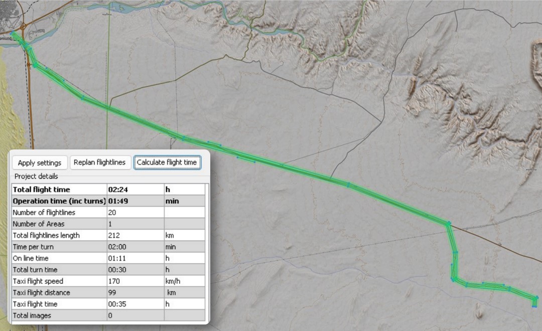
The team created the corridor flight lines and set payload parameters in BortBiZ-Plan, then checked how changes in speed, altitude, overlap, pulse rate, reflectance and point density would affect the final mission. This made the mission easier to visualise, explain and adjust before take-off.
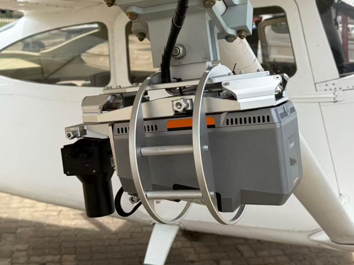
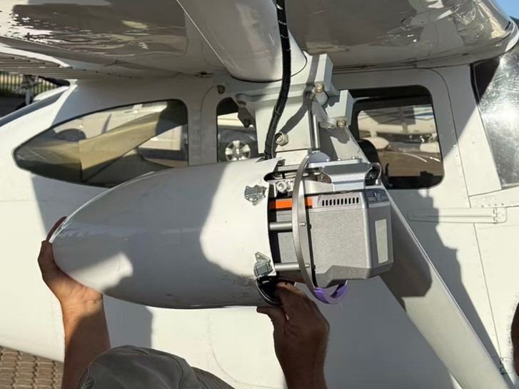
After the mission parameters were confirmed, the team installed the AA15P on the Cessna 182 using the integrated Alpha Mount system. Its tool-free quick-release design simplifies payload installation and reduces pre-flight setup complexity by eliminating many of the bolts, cables, and connection points commonly associated with traditional payload integration workflows, streamlining preparation and improving operational efficiency.
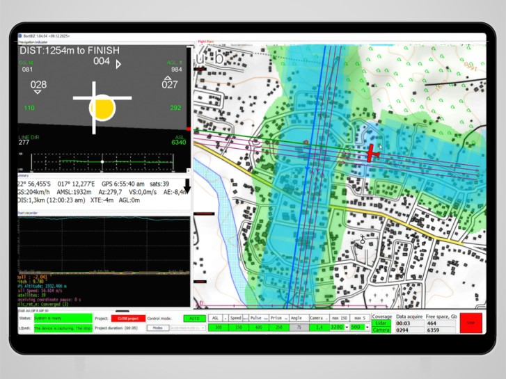
Once the aircraft was prepared and the system was ready for flight, the team used BortBiZ-NAV to manage the mission and monitor payload status in real time. During the flight, BortBiZ-NAV provided pilot guidance, enabled real-time adjustment of the laser pulse repetition rate, allowed data acquisition to be paused and resumed, and displayed real-time storage levels for both the LiDAR and camera. This real-time visibility was essential for efficient data management and continuous monitoring of system status.
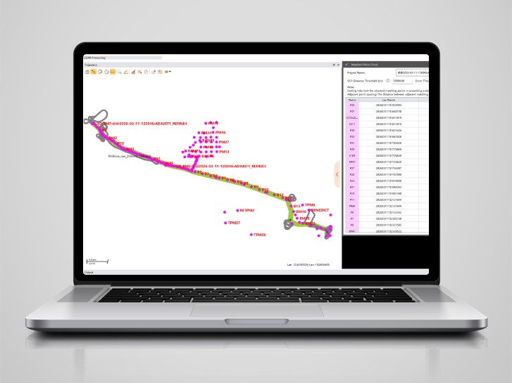
After the flight, the collected LiDAR and imagery data were transferred into CoPre for initial processing and quality control. CoPre was used to calculate the trajectories, create the point cloud, colourise it using the imagery, and write out the orthophoto. It also handled strip adjustments, ground control point adjustments and quality checks, so the data was clean and aligned before final production.
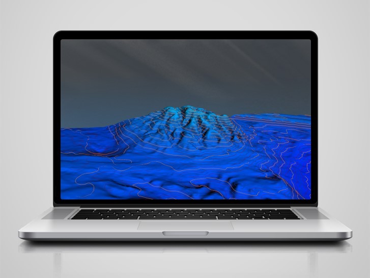
With the data pre-processed and quality checked, the team moved to final production in CoProcess. The data was exported from CoPre into CoProcess for classification, DEM generation and contour production. Final deliverables were exported in formats such as LAS, LAZ and E57, ready for the client's downstream production.
The connected workflow turned around a large corridor dataset on a tight schedule. The full 70 km corridor was captured, processed, checked and exported by the end of the following day, and the clean, dense point cloud allowed classification to be completed in under one day. Very little noise and no layer separation were present even before noise filters or strip adjustments were applied.
| Metric | Result |
|---|---|
| Corridor length | Approximately 70 km |
| Survey window | 2 days in the field |
| Field to deliverable | Captured, processed, checked and exported by the end of the following day |
| Point density | Approximately 80 points per square metre average, up to 121 points per square metre, close to 150 in high-overlap areas |
| Accuracy | Target of under 5 cm RMSE, comfortably met |
| Corridor coverage | Around 200 m required, an average of approximately 800 m delivered, up to 812 m |
| Deliverables | DEM, 25 cm contours, classified point clouds, exported as LAS, LAZ and E57 |
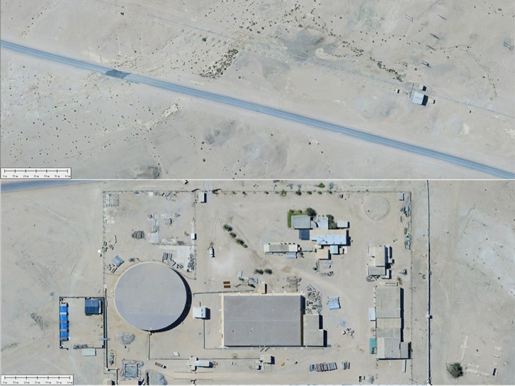
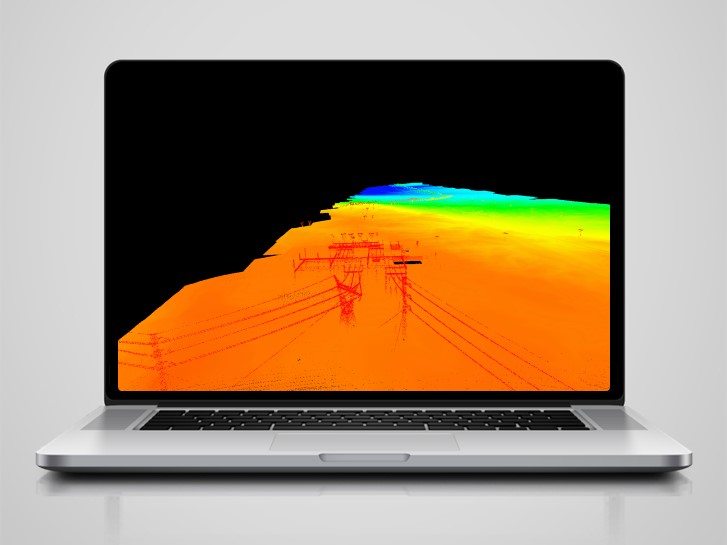
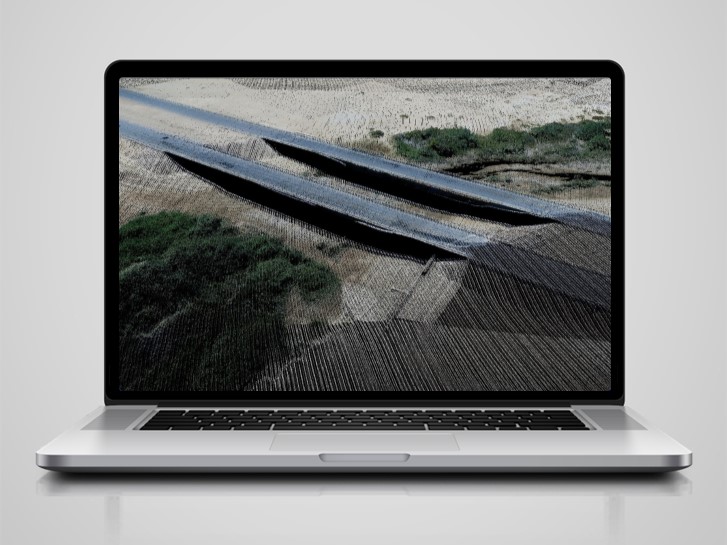
The dense, clean data also made feature extraction straightforward. Detail such as power lines and a bridge along the route came through clearly in the point cloud, supporting reliable mapping outputs across the corridor.
| Aspect | Traditional workflow | CHCNAV AA15P workflow |
|---|---|---|
| Mission planning | Manual calculations, spreadsheets and specialist knowledge; speed, altitude, pulse rate and density calculated separately | BortBiZ-Plan shows the effect of each change clearly, so the team can tune, visualise and adjust every mission faster |
| Fieldwork and flight | Multiple bolts, cables, GNSS antenna, camera hot shoe and separate power, with manual coordination between pilot and operator | Alpha Mount simplifies mounting with fewer connection points; BortBiZ-NAV guides the pilot and controls LiDAR and camera capture |
| Data download | Data downloaded from three different devices in three different formats | The CoPre data copy tool collects LiDAR, trajectory and camera data automatically, with centimetre-accurate photo centre positions |
| Processing and classification | LAS still needed refinement before cleaning and layer separation; classification was slow and manual | After processing, very little noise remains and data can be compared to GCPs directly; classification is automatic, accurate and efficient |
| Performance | 1800 m range, 2000 kHz PRR, 200 Hz IMU update rate, limited flexibility | 3200 m range, 2400 kHz PRR, 600 Hz IMU update rate, with a flexible camera option and multi-platform use |
| Cost and benefits | High cost across a multi-vendor setup | Higher performance and workflow benefits without the excessive cost |
The decision to choose the AA15P was based on the complete workflow solution, not only the scanner itself. Strydom & Associates Land Surveyors needed an airborne LiDAR system that could improve capture efficiency, simplify field operations, provide high-quality imagery, increase range, reduce processing time and deliver reliable final outputs. CHC Navigation achieved exactly that by offering a simpler, more comprehensive workflow across both hardware and software. The AA15P also brings improved range and acquisition, with a 3,200 metre range and 2.4 MHz pulse repetition rate, giving teams greater flexibility when planning aerial surveys and helping mitigate the limits of complex terrain.
For survey teams running large corridor projects where a multi-vendor airborne setup is slow and costly, the Namibia survey is a clear data point: the CHCNAV connected ecosystem, combining the airborne LiDAR with integrated planning, navigation and processing software, delivers high-density, standards-ready mapping in a fraction of the time. This connected workflow, built around the AlphaAir 15 Pro and its integrated software ecosystem, is part of CHCNAV's 3D mobile mapping solutions portfolio.
Download the full case study (PDF)
CHC Navigation (CHCNAV) develops advanced mapping, navigation, and positioning solutions designed to increase productivity and efficiency. Serving industries such as geospatial, agriculture, machine control and autonomy, CHCNAV delivers innovative technologies that empower professionals and drive industry advancement. With a global presence spanning over 140 countries and a team of more than 2,200 professionals, CHC Navigation is recognized as a leader in the geospatial industry and beyond. For more information about CHC Navigation [Huace:300627.SZ], please visit: https://geospatial.chcnav.com/about/overview
Want to explore how CHCNAV LiDAR systems may simplify operational workflows and cut turnaround for your mapping project deliverables?







































.png)