We are pleased to announce that CHC Navigation (CHCNAV) will be exhibiting at Commercial UAV Expo 2025, taking place from September 2 to September 4, 2025, at the Caesars Forum - Las Vegas, USA
CHC Navigation (CHCNAV) develops advanced mapping, navigation and positioning solutions designed to increase productivity and efficiency. Serving industries such as geospatial, agriculture, construction and autonomy, CHCNAV delivers innovative technologies that empower professionals and drive industry advancement. With a global presence spanning over 140 countries and a team of more than 2,000 professionals, CHC Navigation is recognized as a leader in the geospatial industry and beyond.
Commercial UAV Expo is the leading international trade show and educational conference for professionals integrating and operating UAVs/UAS. This year, 225 exhibitors and more than 4,000 attendees from over 60 countries will convene in Las Vegas at the leading event for the commercial drone industry.
Featured Solutions at Commercial UAV Expo 2025
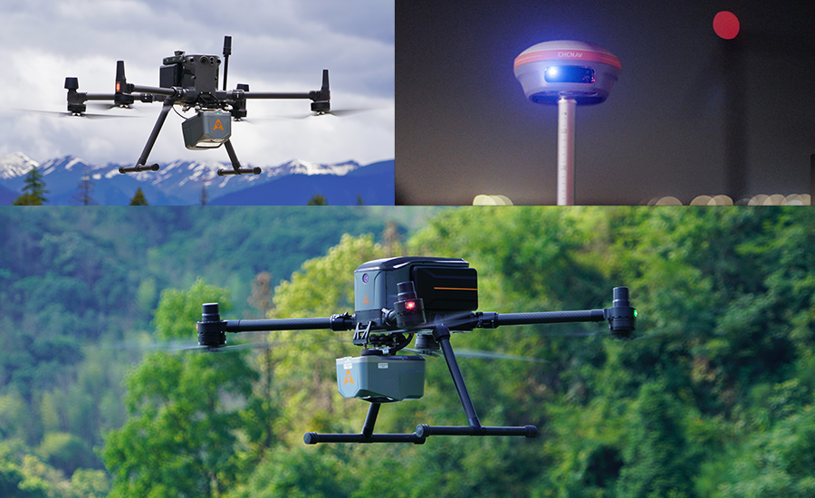
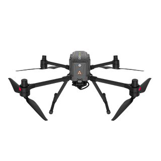
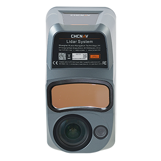
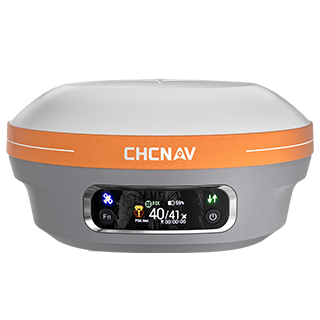
Explore CHCNAV’s geospatial solutions, from professional multirotor drone and airborne LiDAR + RGB system to IMU-RTK GNSS technology.
X500 rotor UAV excels with exceptional payload capacity and endurance, delivering superior maneuverability and stability through advanced flight controls and high-precision positioning. Built-in visual SLAM and obstacle detection radar ensure intelligent, safe operations. Its compatibility with various CHCNAV and third-party sensors makes it ideal for demanding professional tasks like surveying, surveillance, emergency response, and inspections.
AlphaAir 10 is an advanced professional airborne system integrating high-performance LiDAR, a full frame orthophoto camera, precise GNSS/IMU positioning, and CHCNAV's fusion software. This combination delivers survey-grade accuracy and efficiency for UAV LiDAR mapping and photogrammetry.
i83 GNSS receiver is a powerful IMU-RTK solution designed for surveying, construction, and mapping professionals. With 34 hours of continuous RTK operation and advanced power management, it delivers reliable performance for extended fieldwork.
We invite you to visit us at Booth #807 to explore how CHCNAV's geospatial solutions can support your geospatial projects. Engage with our experts to discover tools that can optimize your workflows and deliver accuracy and efficiency!
____
About CHC Navigation
CHC Navigation (CHCNAV) develops advanced mapping, navigation and positioning solutions designed to increase productivity and efficiency. Serving industries such as geospatial, agriculture, construction and autonomy, CHCNAV delivers innovative technologies that empower professionals and drive industry advancement. With a global presence spanning over 140 countries and a team of more than 2,000 professionals, CHC Navigation is recognized as a leader in the geospatial industry and beyond. For more information about CHC Navigation [Huace:300627.SZ], please visit: www.chcnav.com
.png)