CHC Navigation to Showcase Its Latest Geospatial Innovations at MundoGEO Connect 2026
CHC Navigation (CHCNAV) is pleased to participate in MundoGEO Connect 2026 together with its partner CPE Tecnologia. Visitors are invited to meet the team at Stand 304 to explore CHCNAV’s latest geospatial solutions for surveying, mapping, and 3D reality capture.
At the event, CHCNAV will present field-ready technologies designed to help professionals work faster, improve accuracy, and complete projects more efficiently, even in challenging environments. Visitors will also have the opportunity to connect with CHCNAV’s Brazil team and technical specialists, discover exclusive offers, and take part in special activities during the exhibition.
Featured Solutions at MundoGEO Connect 2026
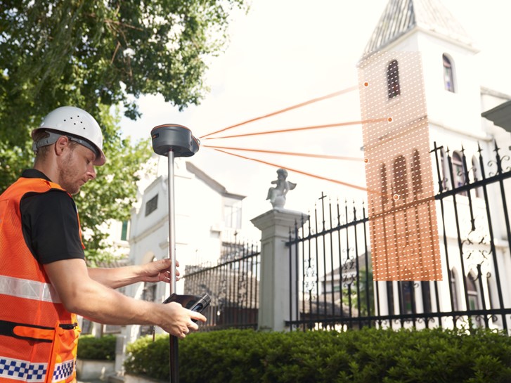
ViLi i100 Visual-LiDAR GNSS RTK Receiver -The ViLi i100 helps surveyors keep working where traditional GNSS receivers reach their limits. By combining GNSS RTK, visual positioning, LiDAR, and SFix 2.0 technology, it delivers reliable centimeter-level results in complex environments such as urban areas, vegetation, and sites with limited satellite visibility.
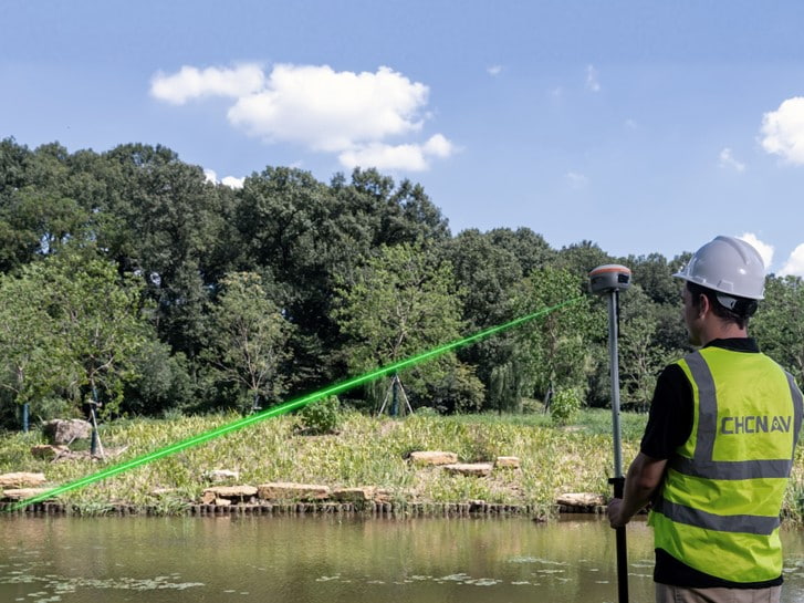
i85 Pocket-Sized Laser IMU-RTK GNSS Receiver -The CHCNAV i85 brings powerful RTK performance into a compact and lightweight receiver. With IMU tilt compensation, dual cameras, an integrated laser rangefinder, and support for the PointSky correction service, it helps surveyors measure points faster, reduce setup constraints, and stay productive throughout the day.
Left: CHCNAV ViLi i100 visual-LiDAR GNSS RTK receiver for surveying in complex environments. Right: CHCNAV i85 pocket-sized IMU-RTK GNSS receiver with laser measurement technology.
RS7 Handheld LiDAR SLAM Scanner -The CHCNAV RS7 makes 3D reality capture faster and easier for buildings, interiors, and complex spaces. Its handheld SLAM workflow, high-density LiDAR scanning, HD imaging, and cloud-enabled processing help teams capture complete 3D data and turn it into usable deliverables with greater efficiency.
CHCNAV RS7 handheld LiDAR SLAM scanner for indoor mapping and 3D reality capture.
About MundoGEO Connect 2026
MundoGEO is one of Latin America’s leading events for geospatial intelligence, dedicated to disseminating knowledge, fostering connections, and generating business opportunities in the aerospace sector, covering areas such as drones, mobile robotics, geospatial technologies, geographic intelligence, space, and advanced air mobility (eVTOLs). Learn more at MundoGEO Connect 2026
____
About CHC Navigation
CHC Navigation (CHCNAV) develops advanced mapping, navigation, and positioning solutions designed to increase productivity and efficiency. Serving industries such as geospatial, agriculture, machine control, and autonomy, CHCNAV delivers innovative technologies that empower professionals and drive industry advancement. With a global presence spanning over 140 countries and a team of more than 2,200 professionals, CHC Navigation is recognized as a leader in the geospatial industry and beyond. For more information about CHC Navigation [Huace:300627.SZ], please visit: https://www.chcnav.com/about/overview
Schedule Time With Our Team
Planning to attend MundoGEO Connect 2026? Send us an inquiry to arrange a dedicated meeting and explore how our solutions can support your projects.