The integration of UAV technology with advanced GNSS techniques, particularly Post-Processing Kinematics (PPK) and Real-Time Kinematics (RTK), has significantly improved the accuracy and efficiency of airborne surveys. By combining drone mapping platforms with differential GNSS positioning, surveyors can now achieve centimeter-level accuracy across large project areas while covering ground far faster than traditional methods.
A single UAV flight can capture hundreds of hectares of high-resolution spatial data, feeding directly into photogrammetric or LiDAR processing pipelines to produce orthomosaics, digital elevation models, and 3D surface reconstructions. However, the accuracy of this data depends entirely on how precisely the drone's position is known at the moment each image or scan is captured.
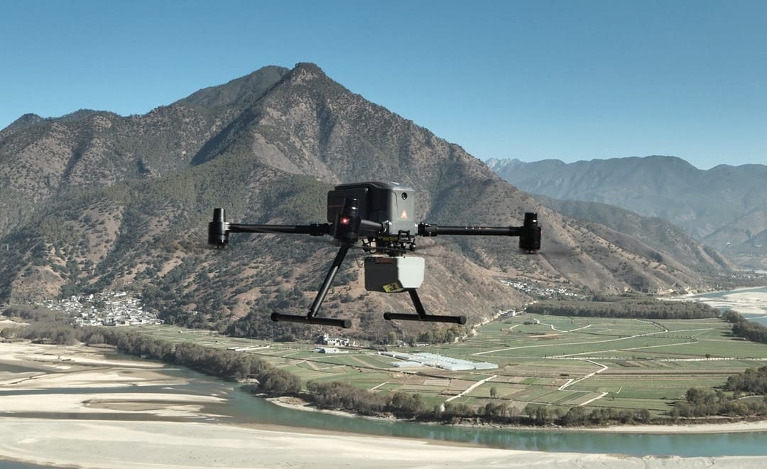
X500 UAV equipped with AlphaAir 6 performing airborne LiDAR mapping.
Onboard GNSS receivers process signals from multiple satellite constellations (GPS, GLONASS, Galileo, BeiDou), but standalone positioning only delivers 1 to 3 meter accuracy. Differential techniques using a GNSS base station correct for atmospheric and orbital errors, bringing accuracy to centimeter level. Two primary methods are used: RTK and PPK.
PPK vs RTK drones: key differences and which to choose?
RTK and PPK are well-established GNSS correction methods widely used in surveying to improve positioning accuracy. In UAV mapping, both enable centimeter-level results and can significantly reduce the need for ground control points.
In aerial survey conditions - where connectivity, terrain, and operational constraints vary, the differences between RTK and PPK become more important. Understanding how each method works helps determine the most suitable approach for a given project.
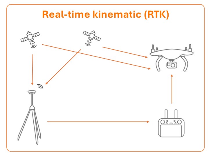
RTK and PPK workflows with real-time corrections between drone and base station.
RTK: Real-Time Corrections
RTK positioning streams correction data from a base station to the UAV in real time, delivering centimeter-level accuracy during flight. The data is georeferenced the moment it is collected, making RTK ideal for time-sensitive applications such as construction progress monitoring, stockpile volumetrics, and corridor mapping where teams need accurate deliverables quickly.
CHCNAV's iBase base station supports this workflow with an all-in-one design that a single operator can deploy within minutes at any field location. The main requirement is a reliable radio or cellular data link between the base and the drone throughout the flight.
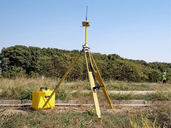
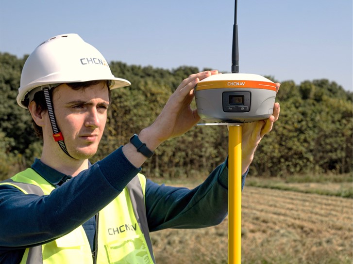
iBase GNSS base station installed in the field for mapping operations.
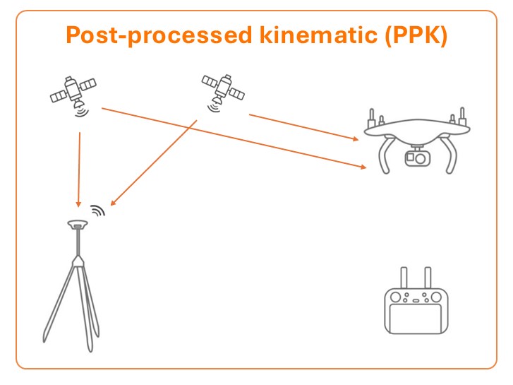
PPK: Post-Flight Flexibility
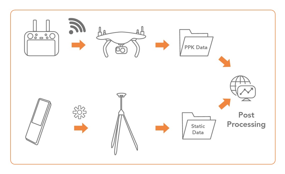
PPK logs raw GNSS data on both the base station and the drone independently. After the flight, software processes both datasets to compute the trajectory with high accuracy. Key advantages over RTK include:
No real-time data link required, making PPK ideal for long-range flights and areas with radio interference.
Longer baseline distances with high accuracy maintained even when the base is farther from the survey area.
Fewer Ground Control Points needed compared to non-differential workflows.
CHCNAV's CGO 2.0 software handles PPK post-processing, combining base observations with drone GNSS data to achieve the highest trajectory accuracy.
CHCNAV PPK workflow: drone flight data and base station static observations are combined in post-processing.
CHCNAV UAV Base Mode
CHCNAV has developed UAV Base Mode specifically for drone survey operations. This feature streamlines the interaction between base stations and drones by enabling direct base-to-drone communication, one-touch GNSS differential output through LandStar8 field software, and flexible start options from either a known coordinate or auto-start mode in areas without existing control.
Combined with the i93 Visual GNSS Receiver, which supplements aerial data with ground-level imagery through its built-in camera, field teams can capture comprehensive survey data from both air and ground perspectives in a single operation.
Choosing the Right Approach
RTK and PPK each serve different operational needs. RTK is the better choice when teams need immediately usable data and the survey area is within reliable data link range. PPK is preferred for large-area campaigns, difficult terrain, or scenarios where post-processing time is acceptable in exchange for greater flexibility. Many professional teams use both methods depending on the project, with some receivers logging PPK data as backup while simultaneously receiving RTK corrections.
As UAV platforms become more capable and GNSS receiver technology continues to advance, airborne surveys are becoming a standard tool across construction, mining, environmental monitoring, and infrastructure inspection. With solutions like the iBase, i93, and UAV Base Mode, CHCNAV provides geospatial professionals with a streamlined workflow that reduces field complexity while delivering the centimeter-level precision that professional applications demand.
____
About CHC Navigation
CHC Navigation (CHCNAV) develops advanced mapping, navigation and positioning solutions designed to increase productivity and efficiency. Serving industries such as geospatial, agriculture, construction and autonomy, CHC Navigation delivers innovative technologies that empower professionals and drive industry advancement. With a global presence spanning over 140 countries and a team of more than 2,000 professionals, CHC Navigation is recognised as a leader in the geospatial industry and beyond. For more information, visit www.chcnav.com.
Have a question about our solutions or dealership opportunities?