CHC Navigation Brings Positioning to Smart Lawn Mowing with MOVA NAVAX 5000 AWD at CES 2026
2026-02-03
Las Vegas, Nevada, January 7, 2026. CHC Navigation (CHCNAV), a provider of positioning and navigation technologies, announced that MOVA has integrated CHCNAV integrated satellite ground service and the high precision positioning chip into its NAVAX 5000 AWD intelligent robotic lawn mower, unveiled at CES 2026. The integrated positioning solution is designed to support centimeter level accuracy for wire-free mowing, without requiring users to install a local RTK base station or subscribe to cellular data plans.
Wire-free robotic mowers are accelerating adoption of virtual boundaries and automated coverage. Many systems rely on local RTK reference stations, network RTK, or cloud connectivity, which can increase installation complexity and introduce ongoing service costs. CHCNAV and MOVA developed a positioning architecture designed to address these limitations through satellite delivered corrections combined with onboard sensor fusion.
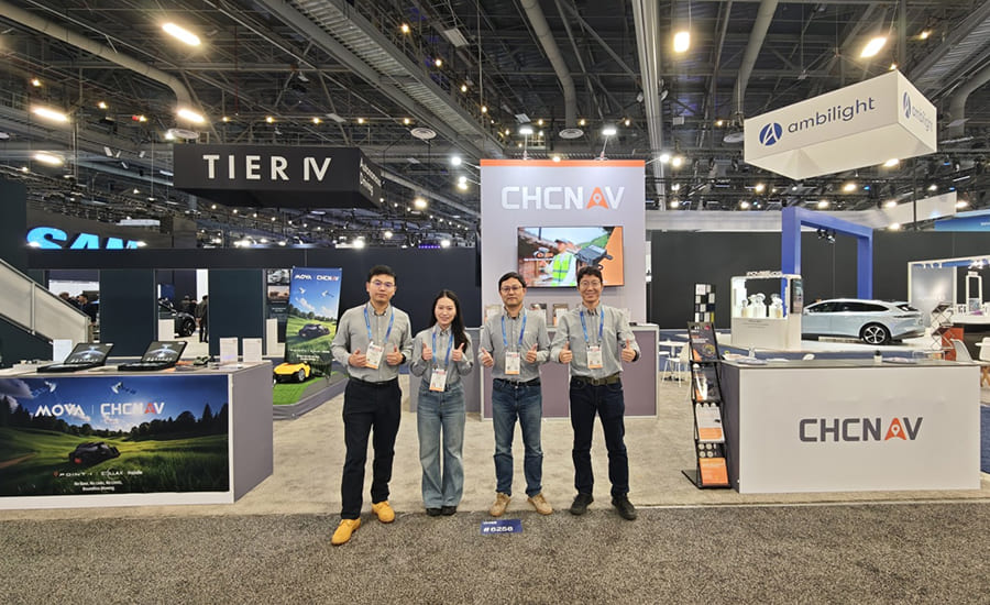
CHCNAV experts present high-precision GNSS technologies for next-generation autonomous robotics at CES 2026 in the USA.
Positioning designed for wire-free mowing without local base stations
NAVAX 5000 AWD uses CHCNAV integrated satellite ground service to deliver GNSS enhancement signals via satellite. With the high precision positioning chip, the mower can achieve centimeter level positioning across supported regions without requiring users to deploy and maintain an RTK base station at home. This approach is designed to reduce setup time, remove routine base station maintenance, and avoid recurring cellular data fees for positioning corrections.
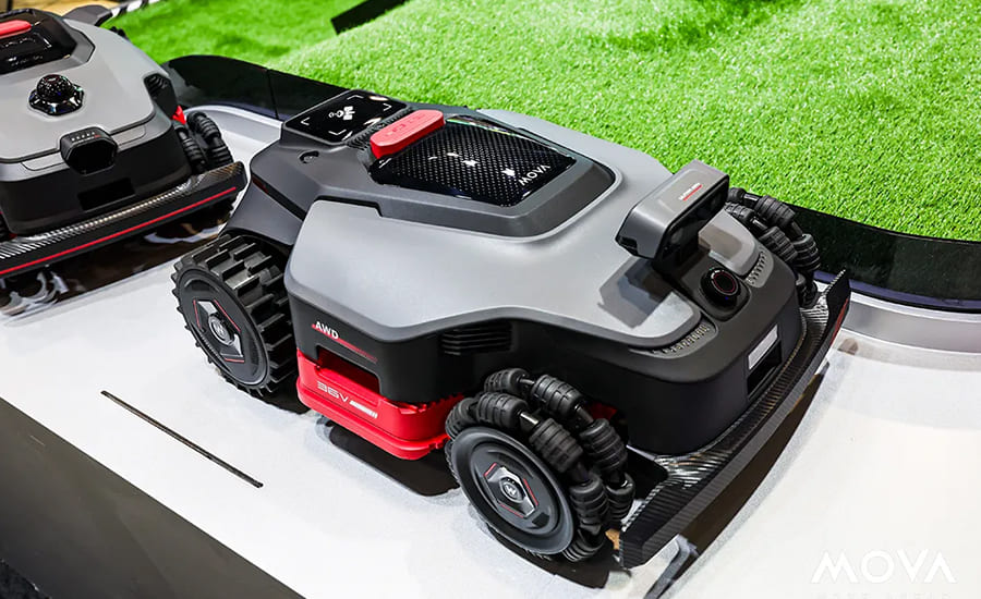
The MOVA NAVAX 5000 AWD robotic lawn mower features wire-free navigation powered by CHCNAV’s centimeter-level satellite positioning and onboard sensor fusion.
Sensor fusion navigation for complex yards
Residential yards often include trees, walls, fences, and buildings that degrade satellite visibility and create multipath effects. NAVAX 5000 AWD combines satellite based RTK positioning with binocular vision and LiDAR to strengthen navigation performance in these environments.
The system is designed to deliver stable positioning and consistent path tracking in obstructed areas where traditional GPS RTK only approaches can be difficult to sustain.
Concept illustration of NAVAX 5000 AWD uses satellites, binocular vision, and LiDAR for better navigation.
Fast initialization for everyday use
This system integrated satellite ground services support rapid RTK initialization to reduce waiting time at startup. This enables power on and go operation for typical mowing sessions and supports repeated runs with minimal user intervention.
Qin Ling, CTO of MOVA, said: “NAVAX 5000 AWD brings satellite based RTK positioning together with vision and LiDAR to deliver strong performance in network-free and complex yard scenarios. This helps provide consistent mowing results for end users and supports broader adoption of wire-free robotic mowing.”
Pan Jei, Business Line General Manager at CHC Navigation, said: “This collaborative launch highlights the technical maturity and commercial readiness of our integrated satellite ground service and the high precision positioning chip solution. We remain committed to an open ecosystem approach and will continue partnering with global innovators to make integrated satellite ground high precision positioning a core standard for smart lawn mowing robots.”
About MOVA
MOVA is a global smart living brand focused on AI-powered household and outdoor solutions. Its product portfolio spans home care and smart outdoor equipment. MOVA designs connected products and user-friendly experiences that help customers simplify everyday tasks at home and outdoors. Learn more: www.mova-tech.com
____
About CHC Navigation
CHC Navigation (CHCNAV) develops advanced mapping, navigation, and positioning solutions designed to increase productivity and efficiency. Serving industries such as geospatial, agriculture, construction and autonomy, CHCNAV delivers innovative technologies that empower professionals and drive industry advancement. With a global presence spanning over 140 countries and a team of more than 2,000 professionals, CHC Navigation is recognized as a leader in the geospatial industry and beyond. For more information about CHC Navigation [Huace:300627.SZ], please visit: www.chcnav.com