What Defines the Best Land Surveying Data Collection Software Today?
2025-12-31
Field data collection software has evolved from a simple recording tool to a centerpiece of surveying productivity. Today, it influences the efficiency of field crews, the reliability of measurements, and the smooth transfer of data between the field and the office. As projects become more complex and teams more diverse in terms of experience, the role of software has become increasingly important.
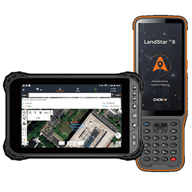
Solutions that endure over time tend to share a common characteristic: they evolve alongside surveyors themselves. Over the past decade, LandStar, CHCNAV's surveying and mapping software, has followed this path, shaped by real-world conditions in the field and continuous user feedback. Reaching more than 500,000 users worldwide is not only a significant milestone in terms of adoption, but also a reflection of how long-term software evolution can translate into practical value in the daily work of surveyors.
LandStar surveying software growth over 10 years, reaching more than 500,000 users worldwide.
Defining the Baseline: What Surveyors Expect from an Efficient Field Software
Fundamentally, surveying software must be reliable. Surveyors rely on consistent performance in GNSS RTK and total station workflows, whether they are working in open terrain or in environments affected by signal obstructions and site complexity. Predictable software behavior directly promotes productivity and confidence in the field.
Today's platforms must also handle complexity without adding friction. Handling dense datasets, multiple coordinate systems, and varied project requirements has become commonplace. Software that has matured over the years tends to refine these capabilities incrementally, resulting in stable workflows that surveyors can rely on, rather than frequent and disruptive changes.
Adaptability to different user profiles is equally important. Field teams often combine experienced professionals with newer operators. LandStar's long-term development has focused on providing clear task logic and configurable workflows, helping teams maintain consistent data quality while adapting to different levels of experience.
Field Usability: From First Use to Daily Efficiency
Ease of use in the field has a direct impact on productivity, especially when teams are working under time pressure or changing frequently. Software that is difficult to master increases training time and the risk of errors during routine tasks.
Platforms designed based on regular user feedback tend to favor intuitive design. LandStar reflects this user-centric approach, focusing on clarity and guided workflows. Features such as dual interface modes allow teams to choose between simplified views for quick familiarization and more detailed layouts for advanced operations. This flexibility allows new users to quickly become productive, while experienced surveyors retain full control over complex workflows.
Over time, this balance between simplicity and depth reduces training costs and allows teams to focus on execution in the field rather than navigating the software.
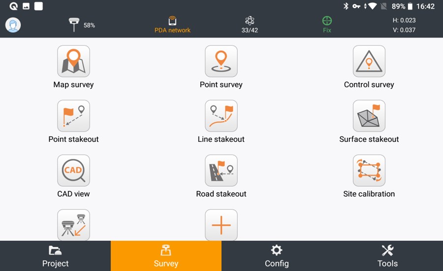
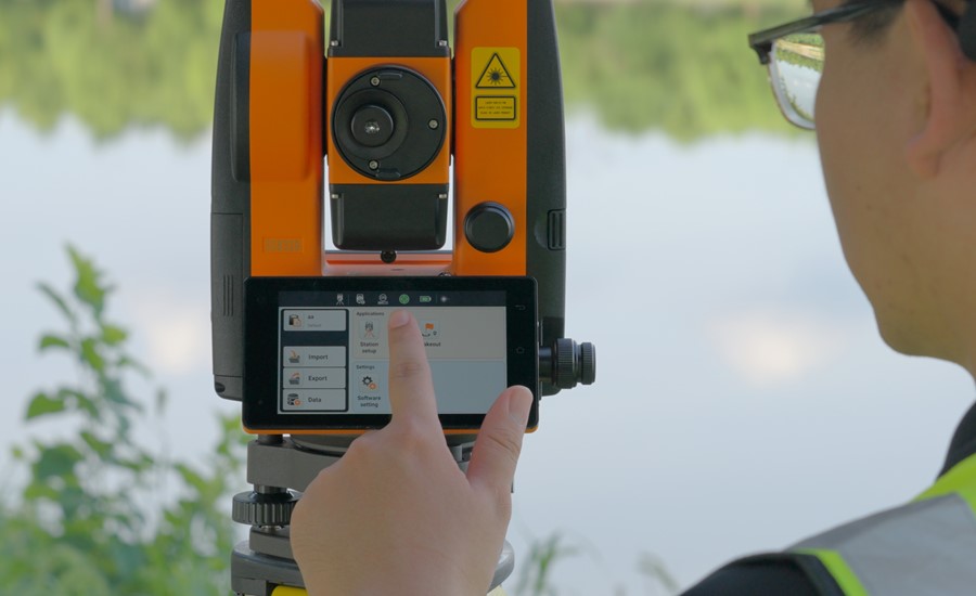
LandStar data collection software interface showing survey and stakeout task navigation for land surveying workflows.
CAD and Data Handling in the Field
As surveying projects grow in detail, field software increasingly needs to work directly with complete CAD datasets. Native support for DWG and DXF files ensures that field views accurately reflect design intent, reducing the need for preprocessing in the office. By minimizing the gap between office design and field execution, this approach reduces iteration cycles and increases confidence in field decisions.
LandStar's development has focused on CAD performance in the field. Its proprietary MetaCAD engine enables fast loading and smooth interaction with large drawings, allowing surveyors to review and work with complex files directly on their controllers. Support for 2D layouts, 3D views, surfaces, and road models helps teams better understand spatial relationships before collecting or staking out points.
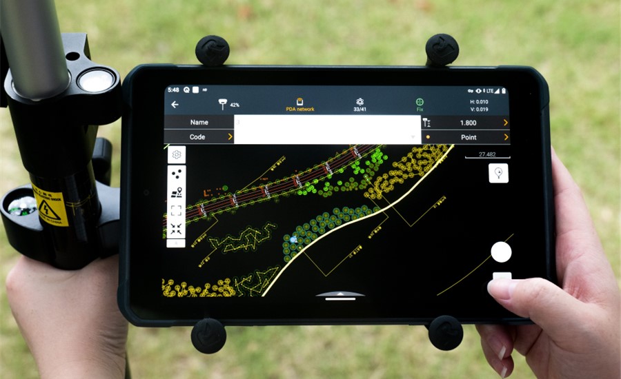
Field data collection with LandStar surveying software on a CHCNAV LT800 data controller during on-site land surveying operations.
Hardware Integration and Positioning Confidence
Field software only reveals its full potential when it integrates seamlessly with surveying instruments. Stable communication with GNSS receivers and total stations is essential for maintaining uninterrupted workflows.
LandStar serves as the central interface within the CHCNAV's surveying ecosystem. It is designed to work closely with GNSS hardware, as well as manual and robotic total stations. This tight integration provides uninterrupted workflows and makes field performance more predictable.
For surveyors, this means fewer re-measurements, less uncertainty, and greater confidence in the accuracy of the collected data relative to actual conditions regardless of whether they are using GPS receivers or total stations.
Localization and Regional Adaptability
While surveying software is often developed for a global audience, field workflows are defined locally. Coordinate systems, standards, and measurement practices vary significantly from region to region, and software must adapt accordingly. By combining global consistency with regional adaptability, advanced software enables surveyors to work efficiently in all regions without sacrificing compliance or familiarity.
LandStar's long-term growth has been accompanied by a strong focus on localization. The platform supports regional workflows in several countries, including specific features tailored to markets such as the United States, Japan, and Europe. This includes support for local coordinate systems, network correction services, country-specific surveying methods, and availability in over 30 languages.
Reliability, Accuracy, and Field Confidence
In daily operations, trust comes from consistency. Surveyors need software that behaves predictably, maintains stable positioning outcomes, and always provides clear information.
Platforms refined through extended field use tend to prioritize stability over adding short-term features. LandStar reflects this philosophy through incremental improvements focused on accuracy, reliability, and transparency. Clear status indicators and consistent system behavior help surveyors trust their measurements without having to constantly validate them. Over years of use, this reliability builds familiarity and confidence, reinforcing trust not only in the software but also in the data it produces.
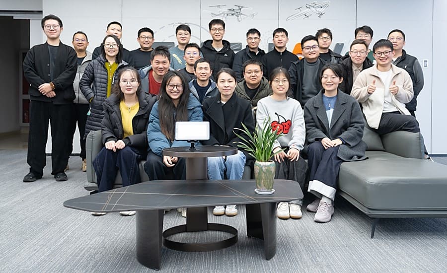
LandStar software engineering team supporting long-term surveying platform development, optimization, and maintenance.
Software Longevity and Development Philosophy
Choosing field software is a long-term investment. Surveying requirements evolve gradually, and platforms that offer lasting value are typically designed around continuous improvement rather than radical redesign.
LandStar's evolution over the past decade reflects sustained investment in research and development, as well as continuity within its engineering team. Updates have focused primarily on improving performance, usability, and compatibility, while preserving familiar workflows. This approach reduces friction during upgrades and protects users' operational efficiency.
Responsiveness to feedback is equally important. Feedback from resellers and field surveyors has played a central role in LandStar's development, ensuring that new features address real-world challenges in the field rather than theoretical use cases.
LandStar surveying software integrated with the CHCNAV CTS-M100 total station for precise field surveying operations.
How to Choose the Right Software for Your Surveying Team
The surveying software landscape includes platforms built around different philosophies, ranging from tightly controlled ecosystems to broadly compatible solutions. Each approach offers advantages depending on operational needs. Choosing data collection software requires aligning technology with actual workflows. Project types, work environments, team experience, hardware strategy, and regional requirements all play a role.
Software that has evolved over the years often proves more adaptable to these variables. LandStar supports a wide range of surveying scenarios, allowing organizations to standardize on a single platform while meeting diverse project requirements. Its ability to adapt to beginner to advanced workflows helps teams grow without having to change tools multiple times.
Landstar: Ten Years of Trust, Built in the Field
After years of experience in the field, most surveyors agree that the true value of data collection software lies in trust. Trust that it will work reliably, that it will handle complex data without difficulty, and that it will assist teams regardless of their level of experience.
Ten years of continuous development and a global community of more than 500,000 users are testament to the trust LandStar has earned. This milestone represents thousands of real-world projects, regional adaptations, and user-driven enhancements that translate into stable and reliable workflows.
As the landscape continues to evolve, software that combines ease of use, performance, localization, and long-term commitment becomes a strategic asset. LandStar's journey demonstrates how a constant focus on real-world needs can create a platform that surveyors can rely on not only today, but for years to come.
____
About CHC Navigation
CHC Navigation (CHCNAV) develops advanced mapping, navigation and positioning solutions designed to increase productivity and efficiency. Serving industries such as geospatial, agriculture, construction and autonomy, CHCNAV delivers innovative technologies that empower professionals and drive industry advancement. With a global presence spanning over 140 countries and a team of more than 2,000 professionals, CHC Navigation is recognized as a leader in the geospatial industry and beyond. For more information about CHC Navigation [Huace:300627.SZ], please visit: www.chcnav.com
Related Products
CHCNAV ViLi i100
Visual-LiDAR GNSS RTK receiver with consistent accuracy in obstructions

.png)