Geographic Information Systems (GIS) are essential for capturing and understanding the spatial dimensions of our world through coordinates, timestamps, and attributes. Accurate GIS data collection is critical for distinguishing nearby assets and maintaining up-to-date information, which is essential for efficient utilities, urban management, and environmental studies. Regular updates are necessary to keep GIS data accurate, as up to 20% of the data can become outdated within a year, affecting informed decision-making.
This article explores the challenges of GIS data accuracy, the innovative solutions provided by CHCNAV, and the methods and benefits of effective GIS data collection.
WHY PRECISE GIS DATA COLLECTION MATTERS?
Accurate GIS data is needed to manage utility infrastructure. For example, knowing the exact location of pipelines can prevent costly damage during excavation, potentially saving millions in repair costs. Statistics show that utilities can reduce maintenance costs by up to 30% with reliable GIS data. In urban planning, GIS data effectively manages urban sprawl, where cities that use GIS for planning can reduce urban development costs by 20%. GIS data is also critical in environmental studies to track land cover and vegetation changes. For example, monitoring deforestation with GIS has improved conservation efforts by 15%.
Challenges in GIS Data Accuracy
Ensuring the accuracy and currency of GIS data is a significant challenge. Data compatibility between central GIS servers and field data collection applications often results in inconsistencies. In addition, providing professional-grade equipment to all field personnel can be costly, as rugged, high-quality devices are typically expensive.
Introducing CHCNAV's MapCloud
To address these challenges, CHCNAV launched the MapCloud software in May 2024. This advanced GIS data collection and mapping application for Android devices, paired with CHCNAV's LT800H Rugged Tablet or LT60H Rugged GNSS RTK Smartphone, provides a comprehensive solution for GIS professionals. This combination ensures accurate data collection and seamless data management, addressing both compatibility and cost concerns.
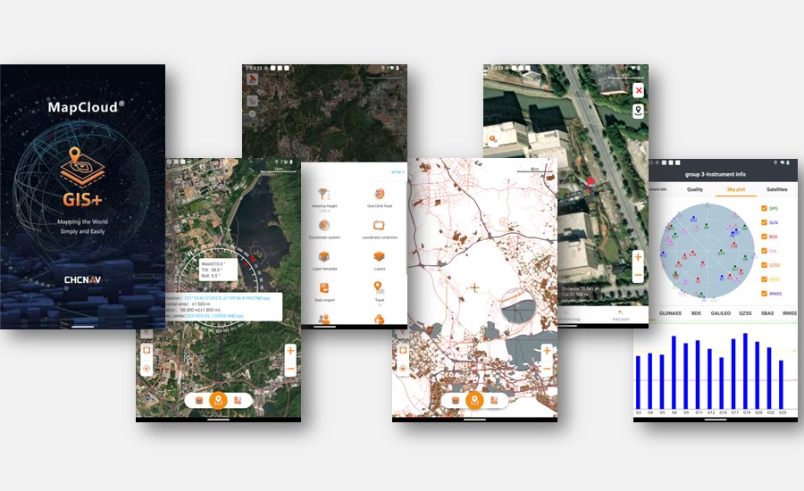
MapCloud - a field data collection software with a user-friendly interface.
METHODS FOR COLLECTING AND MAINTAINING GIS DATA
Field Surveying - is the most traditional method of GIS data collection. It involves the use of surveying instruments such as GNSS RTK (Real-Time Kinematic Global Navigation Satellite System) to measure the spatial coordinates of physical entities with high accuracy. This method is ideal for applications that require accurate measurements, such as pipeline inspections, infrastructure surveys, and construction projects.
Mobile Data Collection - Uses handheld GPS devices, smartphones, and other mobile devices to collect geographic data directly in the field. This method provides a convenient and efficient way to collect points, lines, polygons, and associated attributes. It is particularly useful for distributed data collection tasks such as forestry patrols, utility inspections, and environmental monitoring.
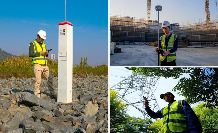
GIS data collection with the tablets, smartphones, and smart antennas from CHCNAV.
Remote Sensing - involves the acquisition of large-scale imagery of geographic features through aerial photography, satellite remote sensing, and LiDAR (Light Detection and Ranging). This method captures comprehensive data over large areas that can then be analyzed and interpreted to extract valuable information. Remote sensing is commonly used for tasks such as land cover mapping, environmental monitoring, and utility network verification.
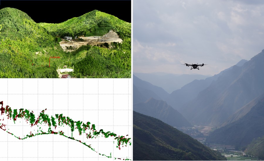
Collection of high-density data with the AlphaAir 15 airborne LiDAR and BB4 UAV platform from CHCNAV.
Integrating Data Collection Methods
These methods can be used independently or in combination to meet specific data collection needs. Integrating existing GIS data resources through data fusion and unified collection strategies can increase efficiency and cost-effectiveness. By leveraging multiple data sources, organizations can achieve comprehensive and up-to-date GIS data sets that support informed decision-making and operational efficiency.
BENEFITS OF USING DEDICATED AND OPTIMIZED GIS DATA COLLECTION SOLUTIONS
Investing in dedicated and optimized GIS data collection solutions offers many benefits to municipalities, large utilities, and SMBs involved in environmental studies. These solutions integrate hardware and software to provide efficient, accurate, and secure GIS data collection.
While both GIS data collection and traditional surveying focus on gathering location information, they serve different purposes and user groups. Traditional surveying emphasizes high-precision coordinate accuracy, which is critical for applications such as cadastral surveying and construction layout. In contrast, GIS data collection integrates detailed attribute information, such as pipeline pressure levels, erosion conditions, or vegetation health.
Enhancing Mobile Workforce Efficiency and Data Security
- Real-time Device Tracking - Devices equipped with GIS applications such as MapCloud can synchronize their locations with a management platform in real time over cellular networks, with notifications sent when devices go online or offline. This feature greatly enhances worker safety. In complex field environments, prolonged inactivity can indicate an emergency situation requiring assistance.
- Rugged Hardware Security - Rugged hardware is critical for GIS fieldwork. For example, an IP67 rating provides protection against dust and water ingress, and the ability to withstand drops of up to 4 feet (1.2 meters) ensures data and device integrity even in harsh conditions.
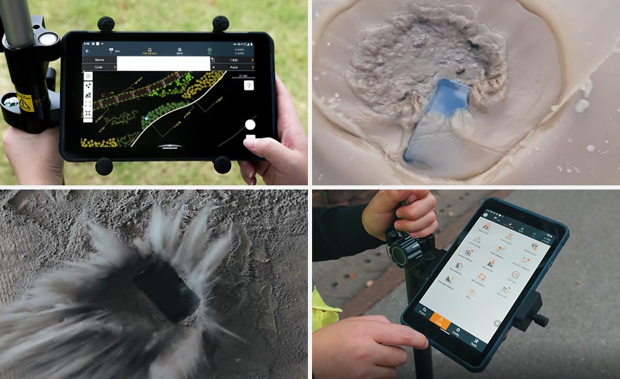
Survey with the LT800 Android tablet tailored for professional applications.
- Advanced Software Security - GIS data can contain sensitive information, so preventing accidental data leaks is critical. MapCloud supports multiple encryption methods to protect data security. It also features a robust backup system for periodic online backups and scheduled local backups to the device or SD card, ensuring data protection even in emergencies.
Prioritizing Productivity in GIS Deployment
- User-Friendly Interface - An intuitive interface is essential to accommodate users of all skill levels. Built-in video tutorials and audio prompts help users get up to speed quickly. Basemaps from sources such as Google, Bing or WMS provide a solid foundation for further GIS work.
- High Performance - An optimized mapping engine supports popular GIS file formats such as SHP, DWG, and DXF, allowing for smooth import and manipulation of large files. MapCloud's engine can handle large datasets efficiently, reducing hardware load and power consumption.
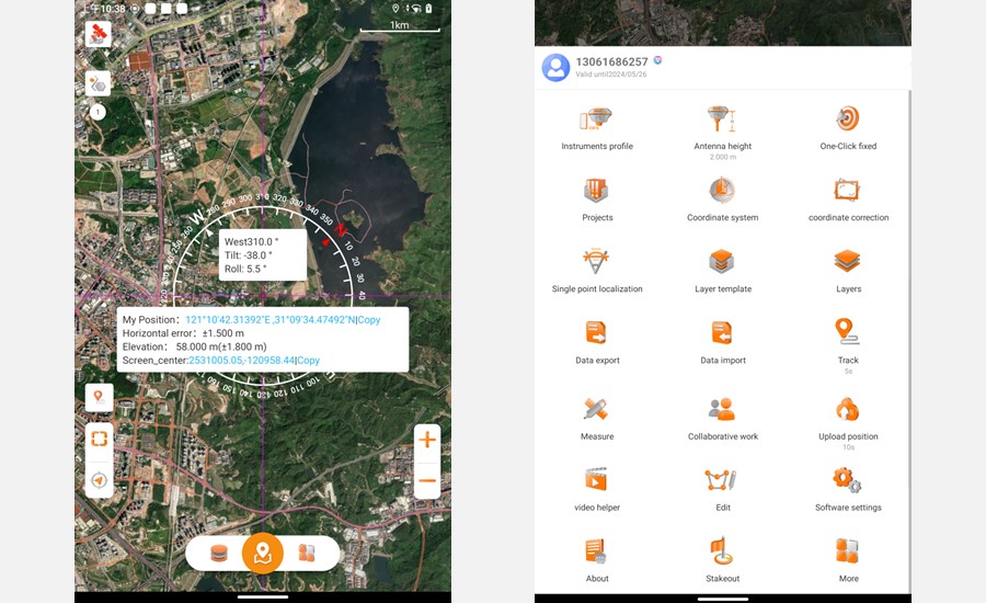
The toolbar of MapCloud software.
Meeting Various Accuracy Requirements in GIS Data Collection Processes
GIS data collection requirements vary widely across industries. CHCNAV's MapCloud and associated hardware provide flexible solutions to meet these diverse needs, ensuring that data collection meets required standards without unnecessary costs. To meet different accuracy requirements, MapCloud offers customizable solutions:
- Consumer Grade GNSS Devices: For general applications requiring meter-level accuracy, the built-in GNSS modules in standard Android devices are often sufficient.
- High-performance GNSS tablets: For applications requiring higher accuracy, such as sub-meter or centimeter accuracy, CHCNAV offers professional-grade devices such as the LT800H rugged tablet.
- Connecting to GNSS RTK Receivers: For users requiring the highest level of accuracy, existing GNSS RTK receivers can be connected to MapCloud, ensuring stable and accurate positioning even in challenging environments.
Facilitating Collaboration and Management in a Connected World
- Enhanced Team Collaboration - Medium and large GIS data collection projects often require the coordinated efforts of multiple teams. GIS data collection applications support enhanced collaboration through built-in cloud connectivity, streamlining team communication and data sharing from the field to the office.
- Cloud-based Project Management - Advanced cloud connectivity greatly improves project management and execution efficiency. Teams can share layer templates and seamlessly transfer files between devices, ensuring all team members can access the most up-to-date data.
WHAT ARE THE COST BENEFITS OF USING PROFESSIONAL-GRADE GIS SOLUTIONS OVER CONSUMER-GRADE ALTERNATIVES?
Choosing the right GIS data collection solution involves considering the benefits of professional-grade devices over consumer-grade alternatives and finding the balance between simplicity and necessary features in field GIS applications.
Professional vs. Consumer-Grade Devices
- Ruggedness and Durability: Professional-grade devices like the LT800H Rugged Tablet are built to withstand harsh environments, resisting dust, water and drops from up to 1.2 meters.
- Enhanced Performance: the LT800H features a large 8" sunlight-readable display, making it easy to view GIS data tables, complex vector and raster maps, and high-resolution images even in bright outdoor conditions. Its high-capacity battery provides extended fieldwork without frequent recharging.
- Superior Accuracy: While consumer-grade GNSS modules offer meter-level precision, professional-grade devices provide sub-meter to centimeter accuracy.
Field GIS Applications: Balancing Simplicity and Features
MapCloud by CHCNAV is designed to strike the right balance between simplicity and the necessary features for effective GIS data collection.
- User-Friendly Interface: MapCloud offers an intuitive user interface with built-in video tutorials and audio prompts, making it accessible to users of all skill levels.
- Comprehensive Feature Set: Despite its simplicity, MapCloud provides a robust set of features. It supports popular GIS file formats and ensures smooth import and manipulation of large files, enabling extensive coverage and rich attribute data.
EMPOWERING GIS PROFESSIONALS WITH CHCNAV SOLUTIONS
CHCNAV's MapCloud and professional-grade Android devices, such as the LT800H Rugged Tablet and LT60H Rugged GNSS RTK Smartphone, empower GIS professionals with efficient, accurate, and secure data collection solutions. By addressing diverse accuracy needs, enhancing team collaboration, and providing robust security features, CHCNAV ensures that GIS professionals can meet the demands of today's geospatial tasks with confidence and precision.
____
About CHC Navigation
CHC Navigation (CHCNAV) creates innovative mapping, navigation, and positioning solutions to make customers' work more efficient. CHCNAV products and solutions cover multiple industries such as geospatial, construction, agriculture, and marine. With a presence across the globe, distributors in more than 120 countries, and more than 1,900 employees, today, CHC Navigation is recognized as one of the fastest-growing companies in geomatics technologies.


