CHC Navigation’s Marine Division makes Unmanned Surface Vessels (USVs) that enable hydrographic and bathymetric surveys in all waters from coastal zones, ports, and harbors to inland waterways or lakes. To support the rapid growth of its Marine Division, CHC Navigation opens dealership opportunities to the Marine Survey professionals in several countries and regions.

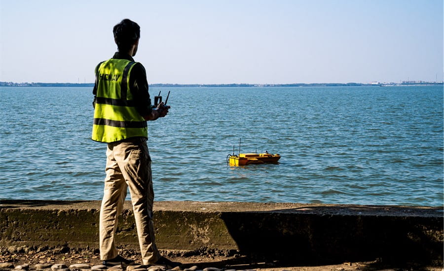
Figure 1. Making bathymetric survey with the help of Apache 6 USV
The autonomous USV series, which includes Apache 3, Apache 4, and Apache 6 marine drones, is engineered to access waters that are too shallow for traditional manned survey vessels or difficult to access. It is an effective and affordable solution for hydrographic surveying tasks, such as docks and harbors engineering, irrigation, river works, land reclamation, water power works, flood control, sewage disposal. Our dealers have a choice to represent one or more marine products based on the potential customers’ needs in their region.
APACHE 3 USV
The APACHE3 is a single-person-portable USV with a shallow-draft hull for bathymetric surveys of lakes, inland rivers, and coastal areas. Equipped with a single-beam echosounder, it can be remotely controlled or programmed for full autonomy via 4G communications. The vessel features tightly-integrated GNSS and INS sensors, providing high-accuracy positioning and attitude even under bridges and during GNSS outages. It can maintain perfectly linear travel with a top speed of 5 m/s.
APACHE 4 USV
The APACHE4 USV is a shallow-draft vessel designed for hydrographic, bathymetric, and hydrological surveys, supporting a wide variety of Acoustic Doppler Current Profiler (ADCP) systems for discharge measurement. With a payload capacity of up to 30kg, the versatile USV can also carry a wide range of other sensors and includes a built-in single-beam echosounder to complement ADCP data. In addition, the vessel features tightly integrated GNSS and INS sensors for smart positioning and navigation, with a sophisticated control system that provides stable hovering in turbulent flow and allows the USV to navigate in a straight line along the cross-section of the flow. The fully autonomous APACHE4 can be safely operated from the shore via 4G communications.
APACHE 6 USV
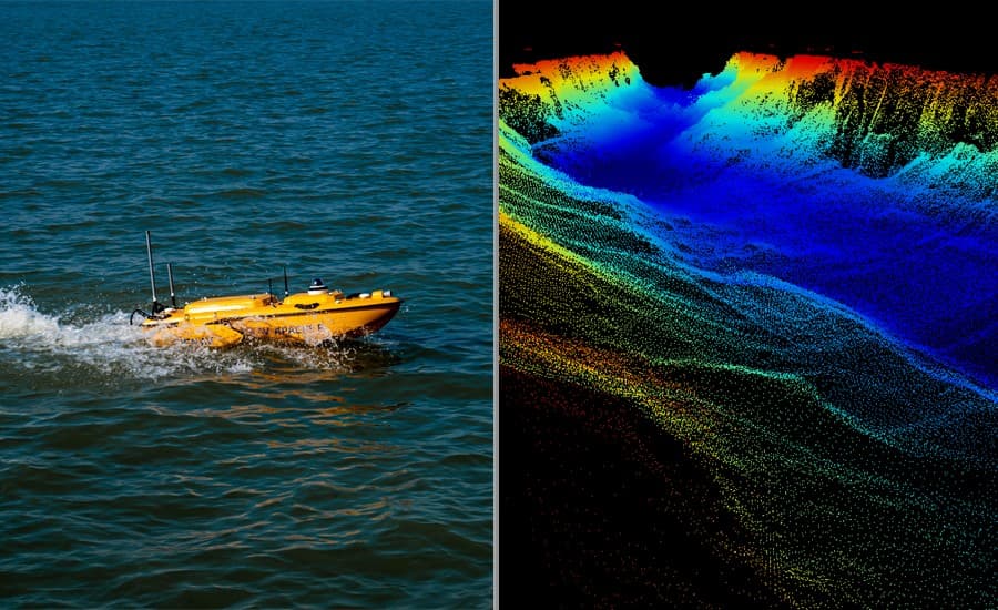
The APACHE6 is a highly versatile USV with a triple-hulled design that can be carried by two operators. Optimized for use with NORBIT multibeam echo sounders, the vessel can undertake various missions, including a 3D bathymetric survey, underwater object positioning, offshore construction, underwater archaeology, and shipwreck location. Powered by a high-performance dual propeller system, the APACHE6 features a stable constant automatic cruise speed of up to 2.5m/s. It can be remotely controlled via UHF or programmed for full autonomy. The APACHE6 can be optionally equipped with an iLiDAR mapping sensor for high-accuracy combined marine and terrestrial 3D surveying, collecting up to 300,000 points per second with a 30x 360 - degree coverage.

Figure 2. Apache 6 USV and its hydrographic survey results
___
About CHC Navigation
CHC Navigation (CHCNAV) creates innovative navigation and positioning solutions to make customers' work more efficient. CHCNAV products and solutions cover multiple industries such as geospatial, construction, agriculture, and marine. With a presence across the globe, distributors in more than 120 countries, and more than 1,500 employees, today CHC Navigation is recognized as one of the fastest-growing companies in geomatics technologies.


