The demand for 3D city models in urban planning and management is increasing. Attributes such as buildings, roads, and trees are key elements, and different building types are among the most important components of these models. Today, airborne technologies are widely used in urban planning because they enable the collection of 3D data over large areas, where photogrammetry is widely used to capture information on the 3D characterizations of objects. However, the geometry and visualization of some buildings, especially in their lower or front parts (facades), can be distorted due to restricted visibility from the air. For this reason, airborne data often needs to be merged with ground-based data to obtain comprehensive and accurate information for 3D city digitization projects.
THE CHALLENGE OF 3D BUILDING MODELING USING AERIAL PHOTOGRAMMETRY
In this study, a detailed 3D model of a pavilion located in the residential complex was necessary to create. Conventional aerial surveys did not provide adequate data to make an accurate 3D model due to the limitations of the drone's aerial view. Complete survey data could not be obtained for certain interior and exterior areas of the building structure. The result was a model that omitted multiple surface areas.
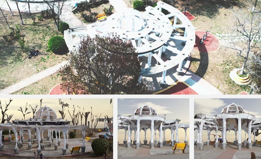
Figure 1. From top to bottom: pavilion and 3D model data obtained with the conventional aerial survey method.
Photographs taken with the traditional camera would not provide an effective solution due to inaccurate location information and misalignment between ground and aerial data. The manual post-processing of these images would also be time-consuming and labor-intensive. The i93 GNSS receiver, which incorporates the latest GNSS, RTK, IMU, and dual-camera video photogrammetry technologies, was selected for this project because it enables fast and accurate data collection in the field.
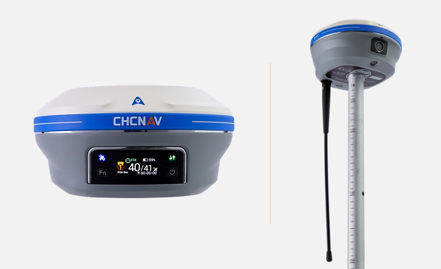
Figure 2. CHCNAV i93 integrates GNSS, Auto-IMU and dual-camera video-photogrammetry technologies.
CAPTURING GIS DATA THROUGH VIDEO PHOTOGRAMMETRY TO INCREASE EFFICIENCY
Continuous video capture of the pavilion using the i93 GNSS was performed in areas where the drone's field of view was limited. The video modeling mode of the i93 GNSS provided 360° video shots of the pavilion from different angles in two independent recordings of the interior parts of the columns, ensuring that the entire structure was covered.
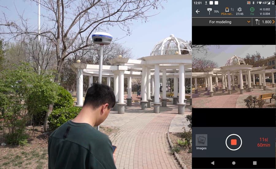
Figure 3. Video measurement of the pavilion with the i93 GNSS in the residential area.
Compared to traditional methods used to improve aerial surveys, video surveying with the i93 GNSS eliminates the need for manual point-and-shoot operations, increasing the efficiency of data collection in the field.
COMBINING AERIAL AND TERRESTRIAL IMAGERY TO SIMPLIFY THE 3D MODELING WORKFLOW
Images and POS data from the drone and the i93 GNSS's camera were extracted for seamless data processing and 3D modeling. Data acquisition with the i93 GNSS is more efficient than traditional methods because it does not require much manual labor, especially regarding image synchronization. The georeferenced images captured by the i93 GNSS are compatible with common modeling tools such as ContextCapture, Smart3D, etc., eliminating the need to define control points. This greatly simplifies the data processing workflow, saving time and labor costs.
The data sets were automatically synchronized in ContextCapture in a new project with two blocks to process the aerial and terrestrial data, respectively. Aerial triangulation calculations were performed on these two blocks to determine each image's correct position and orientation. Because both survey methods use the same geographic coordinate system and high-precision position data, it was possible to combine the data blocks without defining connection points or applying image control points; so that, after aerial triangulation, the data were merged to create a common 3D model, significantly improving accuracy and cost efficiency of the rendering.
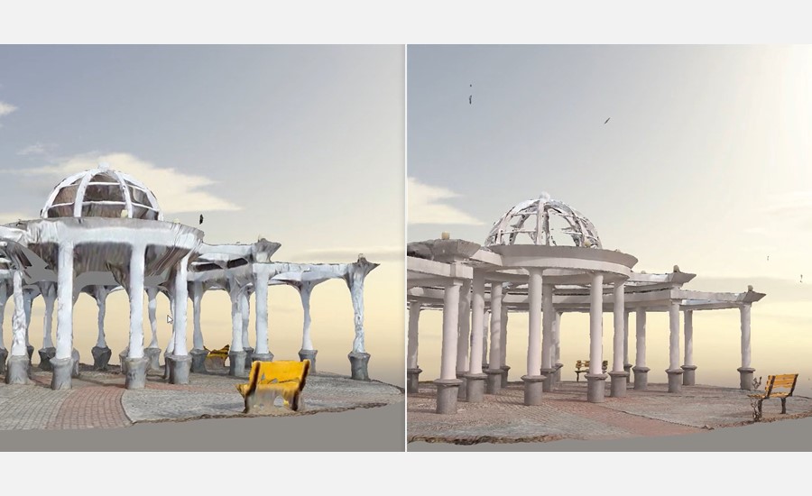
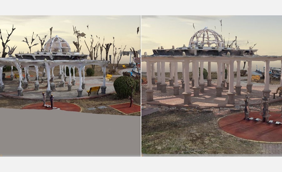
Figures 4,5: Aerial data-based model (left) vs. joint model after reconstruction (right).
GROUND-BASED VIDEO PHOTOGRAMMETRY GAINS MOMENTUM IN REFINING DIGITAL TWIN MODELS
Aerial surveys can gather a large amount of information in a short amount of time. However, using drones to conduct surveys in complex urban environments presents several unique challenges. Safety risks posed by tall buildings and power lines limit the area and height at which drones can operate in cities. To overcome these limitations, ground surveying systems, such as the i93 GNSS, complement aerial platforms and increase the completeness of the information collected for 3D building modeling.
___
About CHCNAV
CHC Navigation (CHCNAV) creates innovative GNSS navigation and positioning solutions to make customers' work more efficient. CHCNAV products and solutions cover multiple industries such as geospatial, construction, agriculture, and marine. With a presence across the globe, distributors in more than 120 countries, and more than 1,700 employees, today, CHC Navigation is recognized as one of the fastest-growing companies in geomatics technologies.


