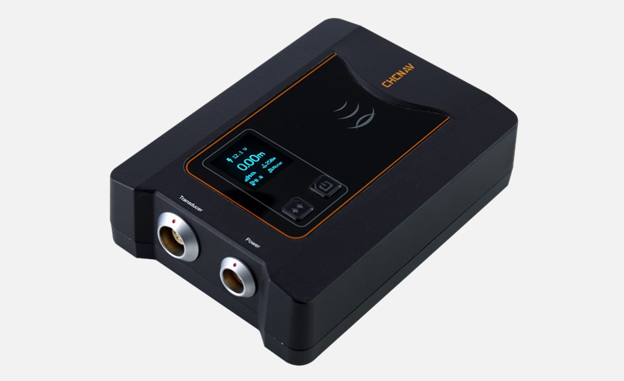
Shanghai, China - November 24, 2023 - CHC Navigation (CHCNAV), a global leader in unmanned hydrographic survey solutions, released the D270, a new single-beam echosounder designed for reliable depth measurement in various marine environments.
With its 200 kHz frequency and built-in temperature sensor for real-time sound velocity correction, CHCNAV's D270 echosounder is effectively used for river cross-section measurements, reservoir capacity assessments, and dredging volume analyses, providing a cost-effective solution that delivers the essential accuracy required for bathymetric surveying.
"The D270 provides surveyors with an optimal balance of performance, portability, and value," said Taxiya Wang, Product Manager at CHC Navigation. "Its rugged, IP67-rated design, easy-to-use wireless connectivity, and highly efficient workflow give users precise echo-sounding capabilities in a lightweight solution."

Figure 1. The D270 single-beam echosounder for bathymetric survey applications.
CONSISTENT ACCURACY ACROSS ENVIRONMENTS
Operating at 200 kHz, the D270 adapts to changing water conditions while minimizing acoustic interference for reliable data collection. Its built-in temperature sensor enables real-time sound velocity correction, significantly improving measurement accuracy.

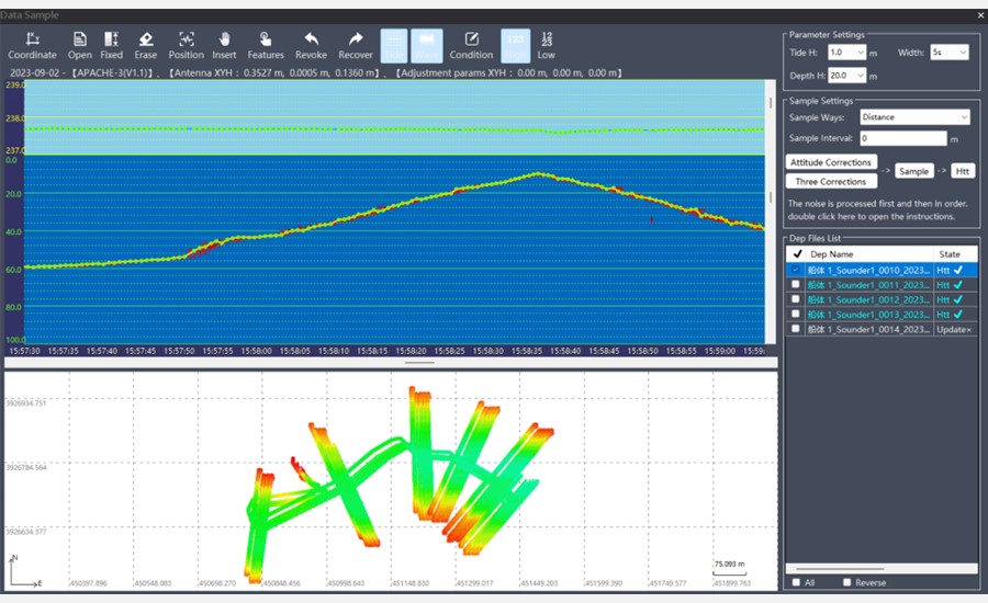
Figure 2. Processing of the raw data collected by the D270 in the Hydrosurvey software.
SEAMLESS DATA MANAGEMENT
With 8GB of onboard storage, the D270 securely captures large volumes of survey data. Its embedded Linux system supports web-based parameter configuration and chart plotting. Data can also be transferred wirelessly to other devices using Wi-Fi and Bluetooth for improved workflow efficiency.
REINFORCED OPERATION SAFETY
The D230 features a rugged IP67-rated waterproof and dustproof design. Operators are alerted to shallow water and data anomalies, ensuring safe operation and reliable survey results even in challenging environments.
The D270 echo sounder offers a practical and reliable solution for surveying and construction activities in marine environments, providing accurate depth measurements and valuable data for a wide range of purposes, such as hydrographic surveying, harbor maintenance, environmental monitoring, marine construction, oil and gas exploration, and bathymetric mapping.
____
About CHC Navigation
CHC Navigation (CHCNAV) creates innovative mapping, navigation, and positioning solutions to make customers' work more efficient. CHCNAV products and solutions cover multiple industries such as geospatial, construction, agriculture, and marine. With a presence across the globe, distributors in more than 120 countries, and more than 1,700 employees, CHC Navigation is recognized as one of the fastest-growing companies in geomatics technologies today.


