CHC Navigation Introduces ViLi i100: A Visual-LiDAR GNSS RTK Receiver for Reliable Accuracy in Obstructed Environments
2025-09-23
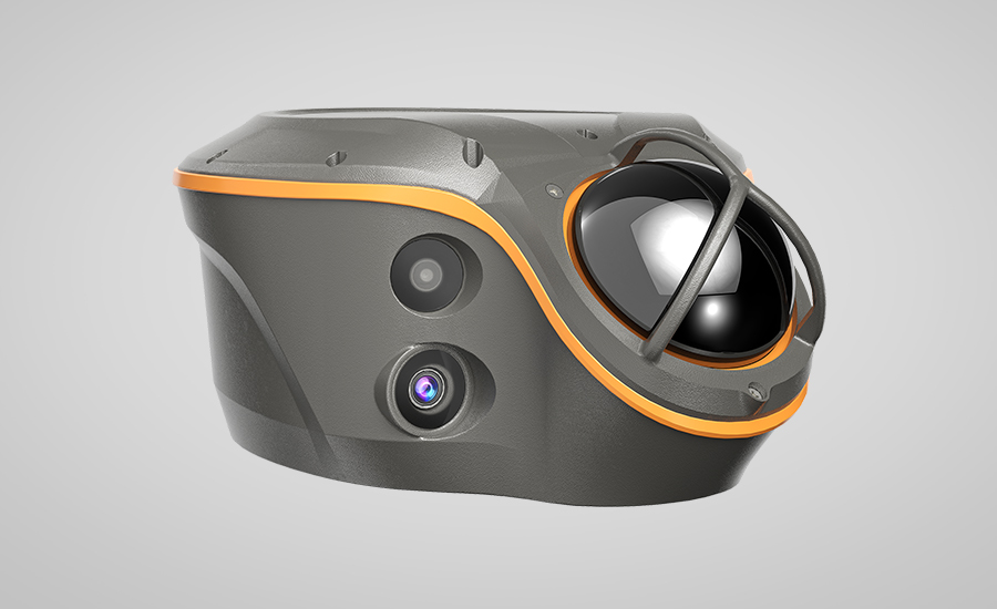
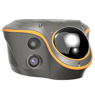
Shanghai, China – September 23, 2025 – CHC Navigation (CHCNAV), a global provider of geospatial solutions, announces the release of the ViLi i100, its flagship Visual-LiDAR GNSS RTK receiver designed for high-precision surveying in challenging environments. By integrating advanced GNSS signal processing, multi-sensor fusion with LiDAR and visual data, and refined positioning algorithms, the ViLi i100 provides consistent, centimeter-level accuracy, even where conventional GNSS receivers face limitations.
“The ViLi i100 is built to extend high-precision GNSS operation into challenging locations where traditional solutions reach their limits,” said Rachel Wang, Product Manager at CHC Navigation. “By integrating Visual-LiDAR, enhanced SFix positioning, and multi-sensor fusion in one device, it enables professionals to maintain quality data capture without changing equipment or workflow.”
Extended Operation in GNSS-Denied Areas
Powered by the enhanced SFix 2.0 engine, the ViLi i100 maintains 5 cm accuracy while moving within a 20-meter radius in GNSS-denied environments. It utilizes 860,000 pts/sec laser data with SLAM-based algorithms to reconstruct its position without direct reliance on satellite signals. This capability allows for uninterrupted work in tunnels, under viaducts, or within deep construction zones, providing a continuous workflow.
Consistent Positioning in Obstructed Environments
The ViLi i100 is engineered for reliability in complex settings. It combines multi-sensor data to intelligently analyze satellite signal paths, automatically filtering out those affected by multipath interference. This process ensures stable, jump-free positioning, delivering consistent 5 cm absolute accuracy in environments such as narrow alleys, dense forests, or near high-rise buildings.
3D Earthwork Measurement and Contactless Surveying
The ViLi i100 integrates high-precision LiDAR sensing with intelligent processing to support real-time earthwork calculations directly on site. Users can define boundaries and receive immediate cut-and-fill or volume results with a high level of reliability, without the need for physical contact with the terrain. The contactless measurement capability enables safe and efficient data collection in hazardous or hard-to-reach areas, such as steep slopes, stockpiles, or active construction zones, while maintaining consistent centimeter-level accuracy.
____
About CHC Navigation
CHC Navigation (CHCNAV) develops advanced mapping, navigation and positioning solutions designed to increase productivity and efficiency. Serving industries such as geospatial, agriculture, construction and autonomy, CHCNAV delivers innovative technologies that empower professionals and drive industry advancement. With a global presence spanning over 140 countries and a team of more than 2,000 professionals, CHC Navigation is recognized as a leader in the geospatial industry and beyond. For more information about CHC Navigation [Huace:300627.SZ], please visit: www.chcnav.com
CHCNAV ViLi i100
Visual-LiDAR GNSS RTK receiver with consistent accuracy in obstructions