Shanghai, China – May 28, 2024 - CHC Navigation (CHCNAV), a leading provider of GNSS technology solutions, today announced the release of MapCloud, an advanced GIS data capture and mapping application for Android devices. This launch marks a significant milestone in CHCNAV's expanding GIS ecosystem, delivering a powerful field data collection tool tailored for surveyors, engineers, and GIS professionals across diverse industries.
"MapCloud represents an important step in our commitment to delivering innovative solutions that enhance customer productivity," said Sans Ma, Product Manager at CHC Navigation. "With its powerful mapping engine, seamless integration with industry-standard formats, and intuitive user interface, MapCloud empowers field crews to accurately capture and analyze geospatial data with remarkable speed and precision."

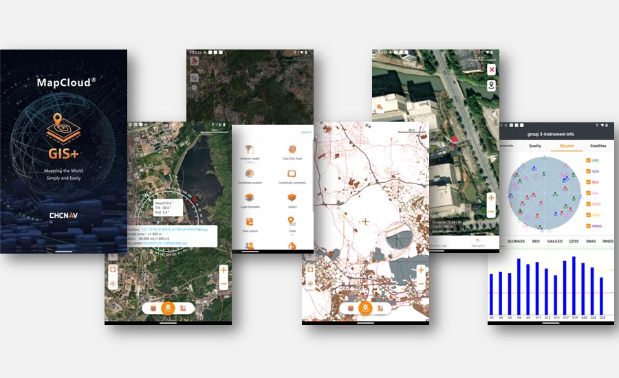
MapCloud, a field data collection software with a user-friendly interface.
SEAMLESS INTEGRATION AND HIGH PERFORMANCE
MapCloud seamlessly integrates with popular GIS file formats, ensuring compatibility with existing software ecosystems and facilitating immediate productivity gains. Its powerful mapping engine handles large files, allowing users to easily load and modify gigabyte-scale SHP files. The mapping engine also enables seamless integration with online base maps and supports data visualization through thematic values and labels.
USER-FRIENDLY DESIGN AND TAILORED FUNCTIONALITY
Featuring an intuitive interface with vivid graphics and large map windows, MapCloud simplifies surveying and mapping operations for users of all skill levels. The software supports thematic maps to enrich data displays, customizable layer templates, and multi-feature capture capabilities, which enhance efficiency by over 50%. The software supports various data types, extensive attribute libraries, and global coordinate systems. Essential functions like coordinate stakeout, track recording, and measurement tools are augmented with audible prompts for ease of use in the field.
COLLABORATIVE CLOUD FRAMEWORK
MapCloud's integrated cloud-based framework facilitates team collaboration by enabling project backup, data sharing, and extensive storage capabilities. The Sharing Code feature streamlines project data transfer between office computers, field controllers, and mobile devices, ensuring teams remain connected and informed throughout multi-site project management and execution.
MapCloud by CHCNAV is a versatile tool that empowers professionals in various industries, including pipeline management, forestry, utilities, municipal asset management, and natural resource inventory. Its powerful performance, user-friendly design, and collaborative cloud framework enable these professionals to enhance operational efficiency and accuracy in geospatial data capture and mapping, revolutionizing their workflow and productivity.
____
About CHC Navigation
CHC Navigation (CHCNAV) creates innovative mapping, navigation, and positioning solutions to make customers' work more efficient. CHCNAV products and solutions cover multiple industries such as geospatial, construction, agriculture, and marine. With a presence across the globe, distributors in more than 120 countries, and more than 1,900 employees, today, CHC Navigation is recognized as one of the fastest-growing companies in geomatics technologies.


